
Updated on April 23, 2025
Day 3 of October 2024 Trip to Acadia National Park
Another day spent hitting trails and overlooks in Acadia National Park, with perhaps more vibrant foliage and even larger crowds than the previous day.
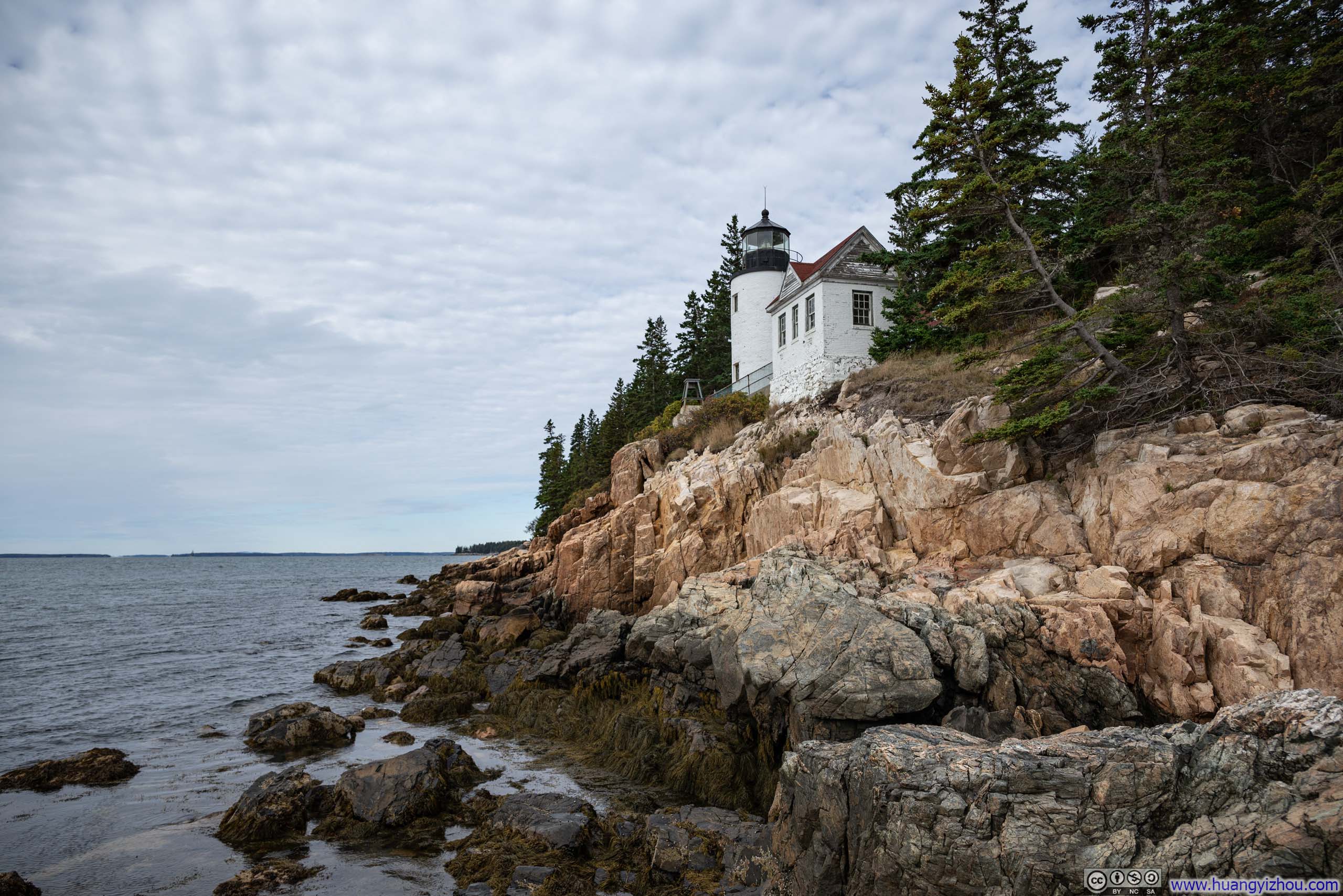
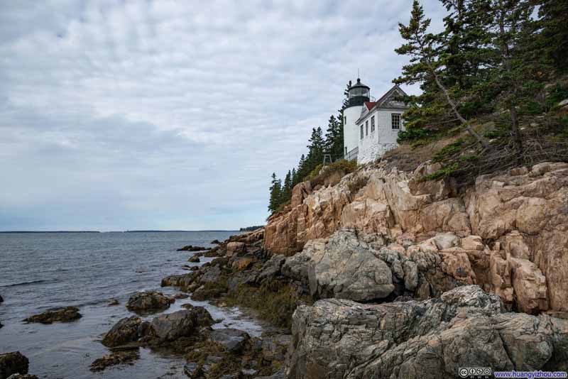
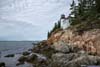
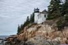
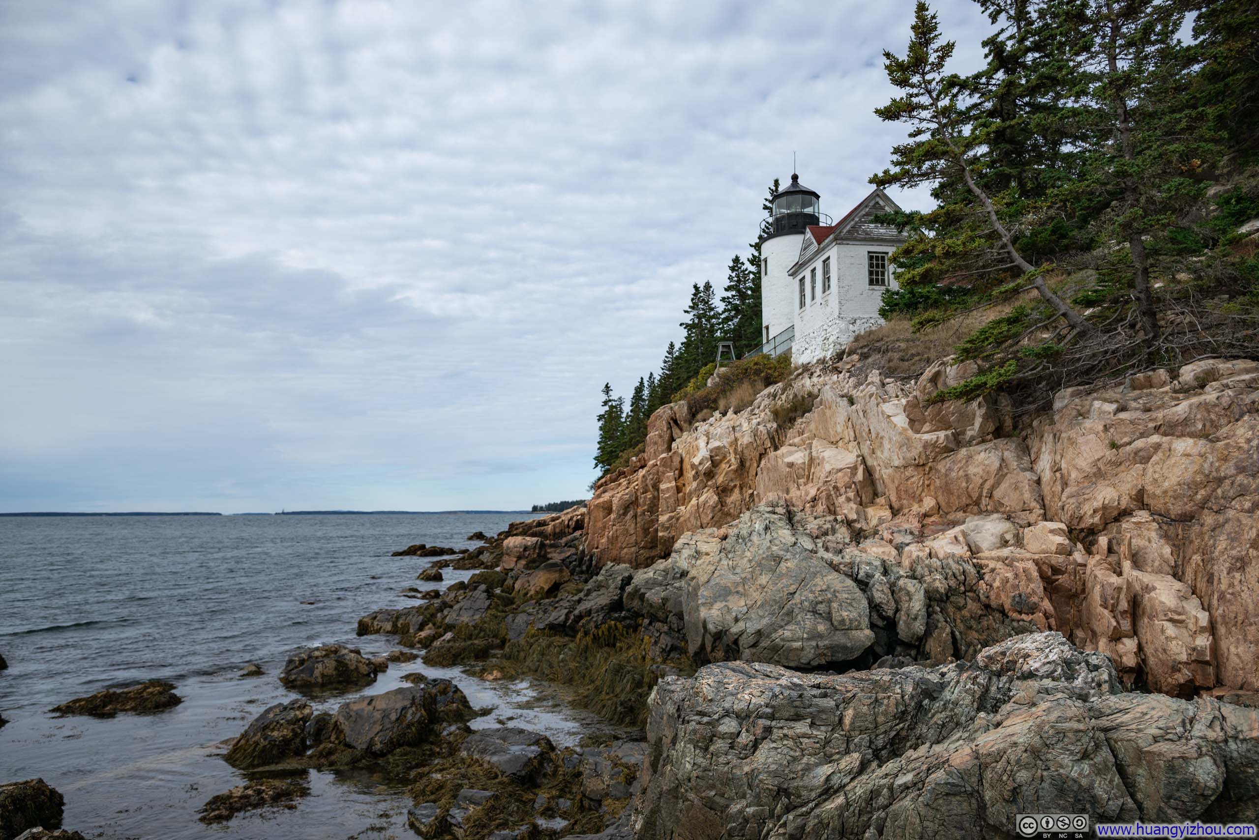
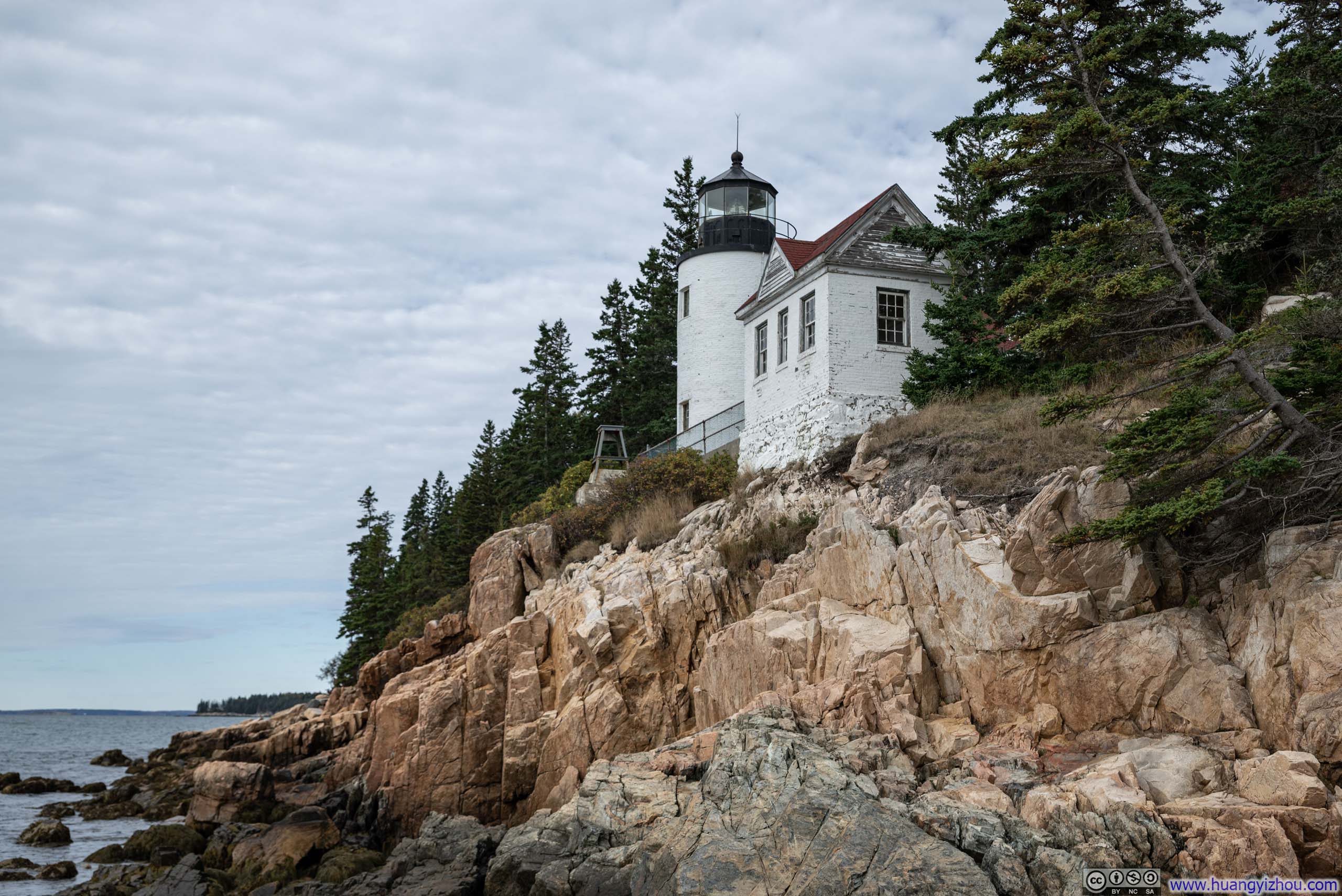
Bass Harbor Head Light Station
After exploring some trails (Sargent Mountain Loop and Precipice) in Acadia National Park the previous day, my plan for the day was to tackle one or two more (such as Bar Island, Jordan Pond or Beehive), before making the drive back to Boston in the evening.
Bass Harbor Head Light Station
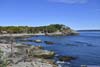
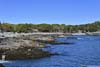
This was a lighthouse located on the southern end of Mt Desert Island, at the mouth of Bass Harbor. Constructed in 1858, this lighthouse was perched on a rocky cliff overlooking a rugged coastline, making it a favorite subject for dramatic photography.
Since this lighthouse was located somewhat out of the way compared to other attractions of Acadia National Park, I decided to visit it first thing in the morning. Its parking lot held about 20-30 cars, which was full by the time I arrived around 10am, resulting in a 10-minute wait.
From the parking lot, a short path led down the cliffs to its iconic postcard-worthy views (p1-p2 below). There was also a separate path leading to the actual lighthouse (p3 below), which was closed to the public.
 Bass Harbor Head Light Station
 Bass Harbor Head Light Station
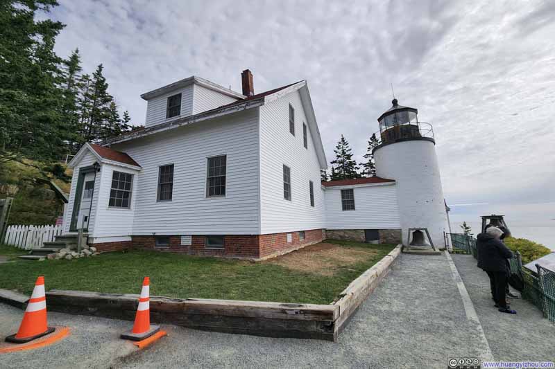 Bass Harbor Head Light Station
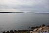
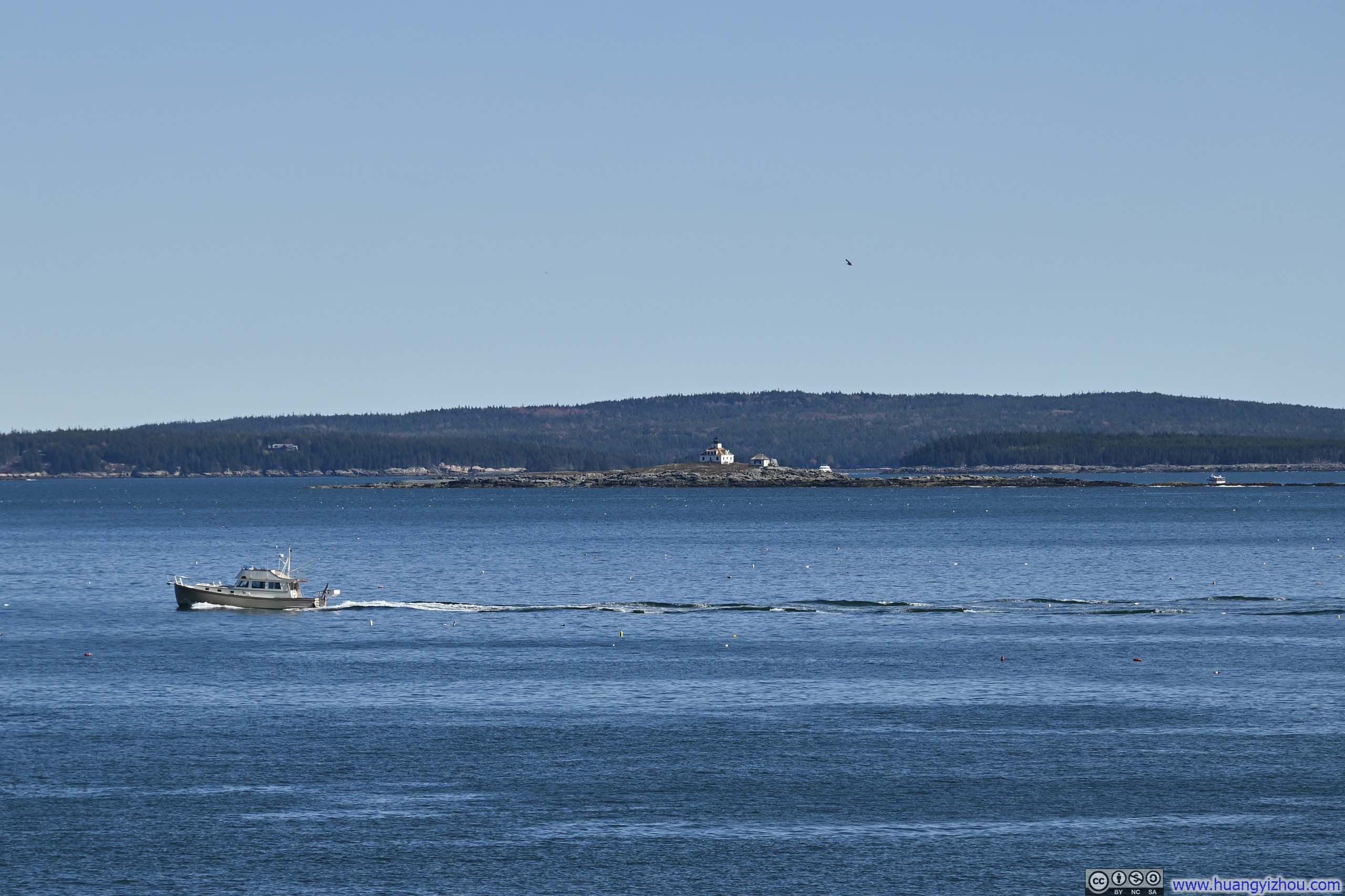
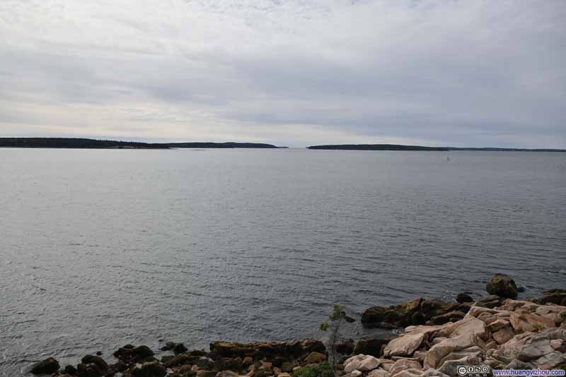 Islands off Bass Harbor
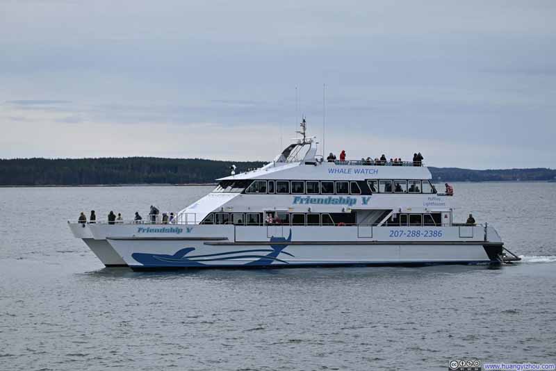 Tour Boat off Bass Harbor Head LightI would see the same boat again later at Newport Cove.


Click here to display photos from Bass Harbor Head Light Station.
Bass Harbor Head Light Station
Bass Harbor Head Light Station

Bass Harbor Head Light Station
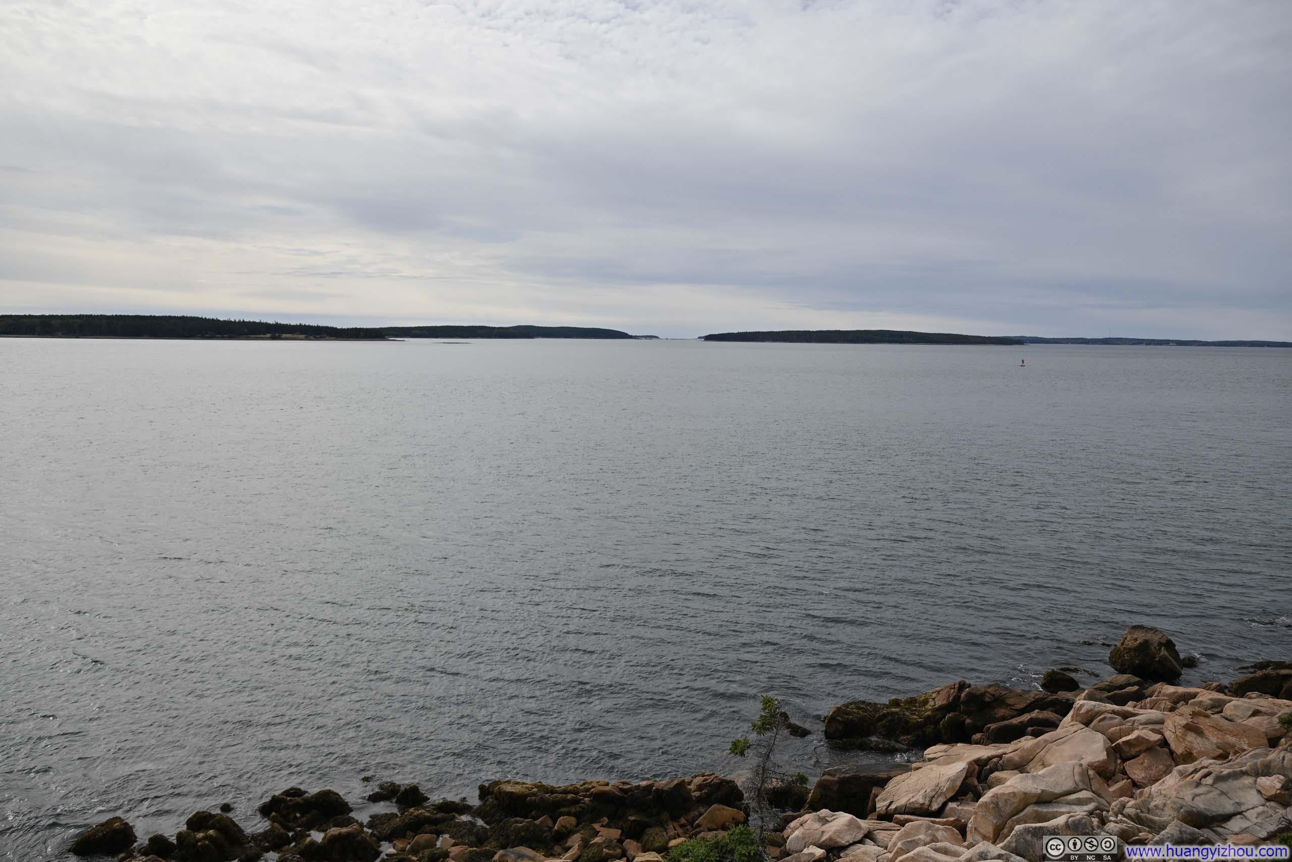
Islands off Bass Harbor
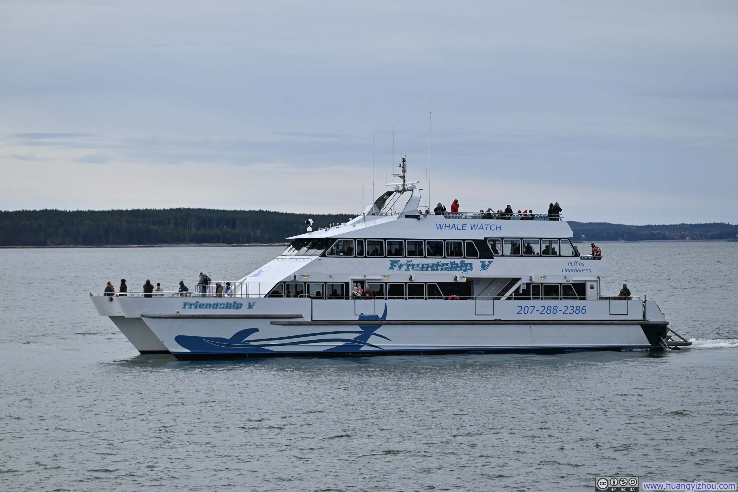
Tour Boat off Bass Harbor Head LightI would see the same boat again later at Newport Cove.
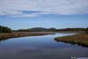
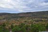
Bass Harbor Marsh
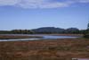
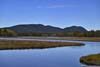
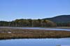
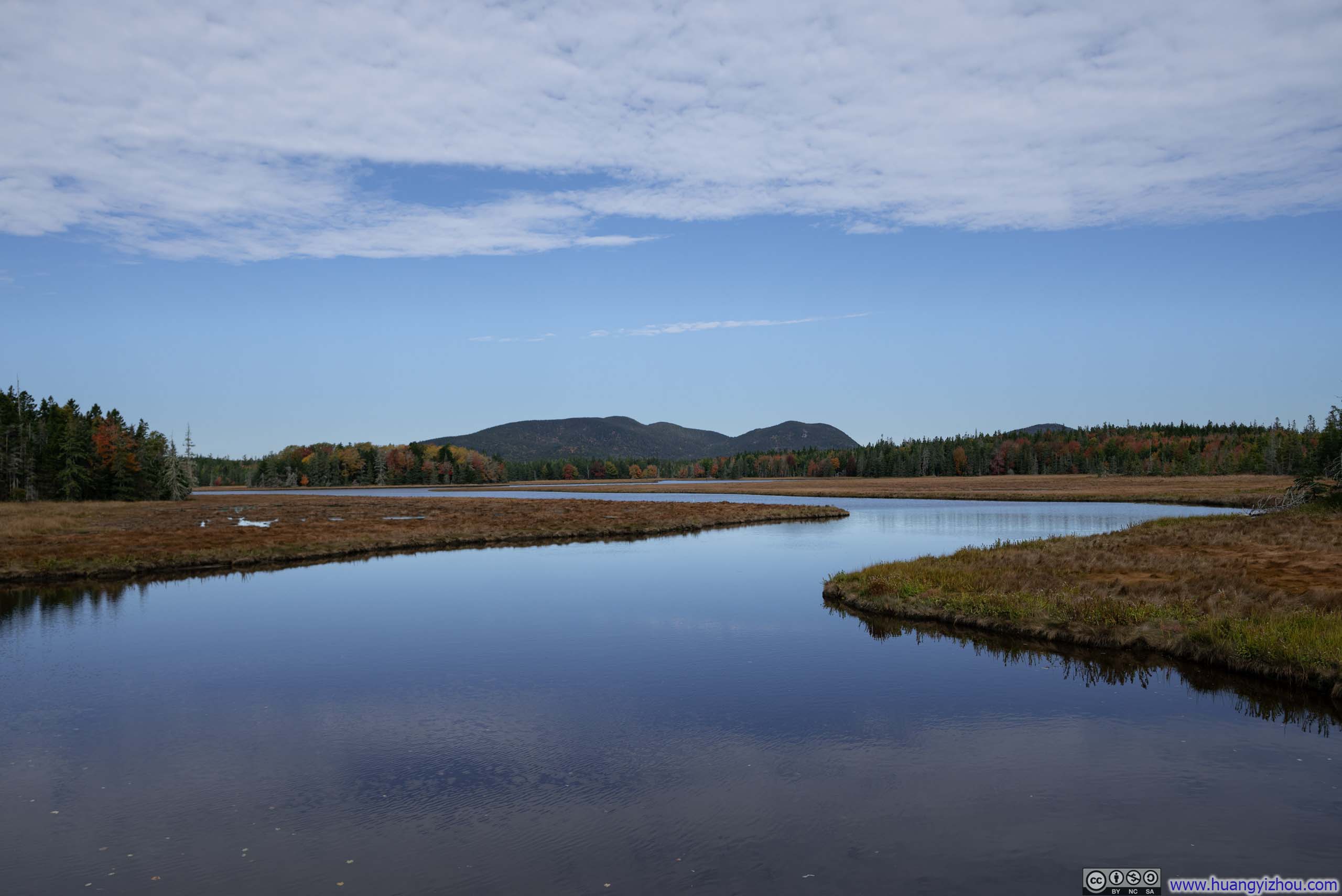
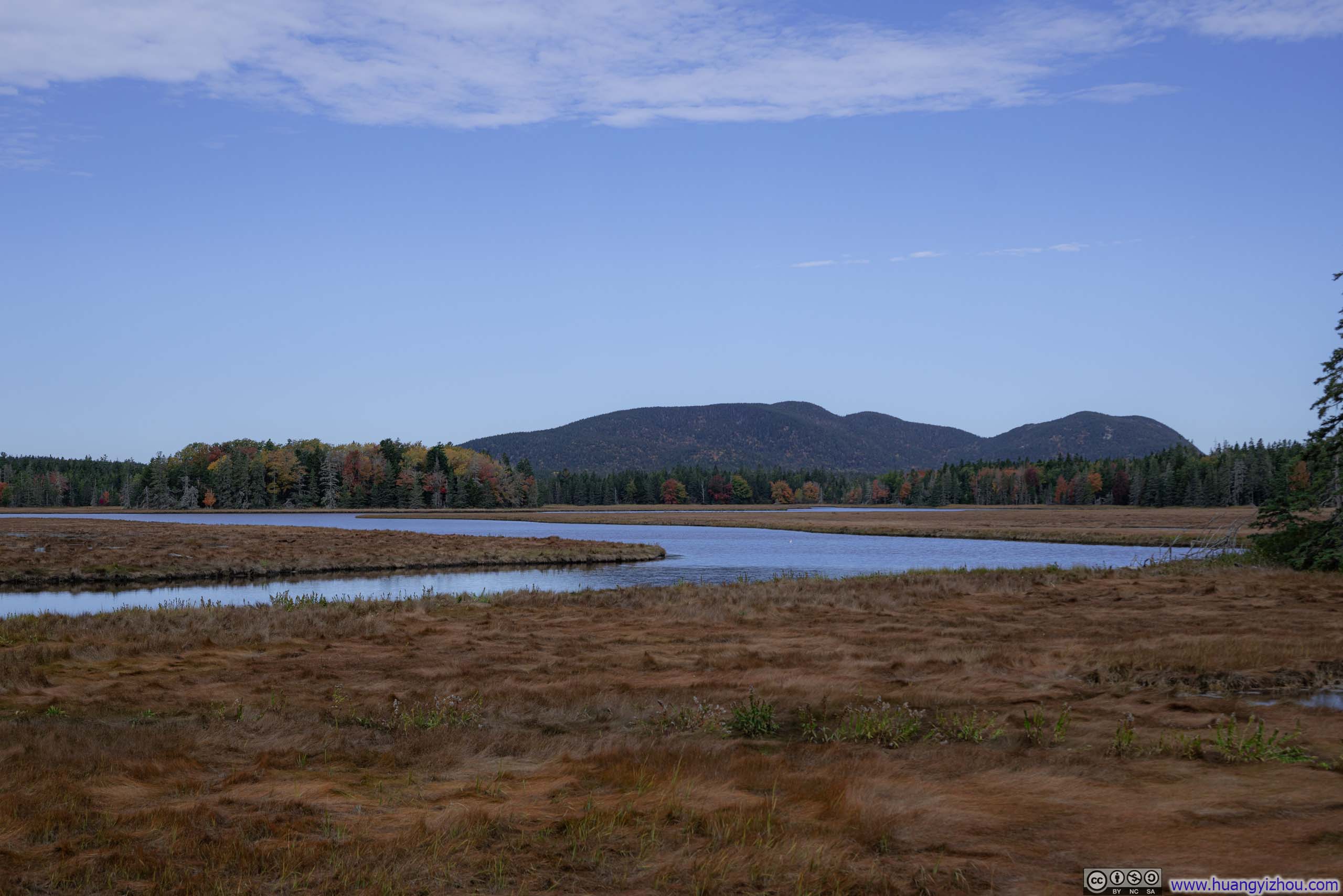
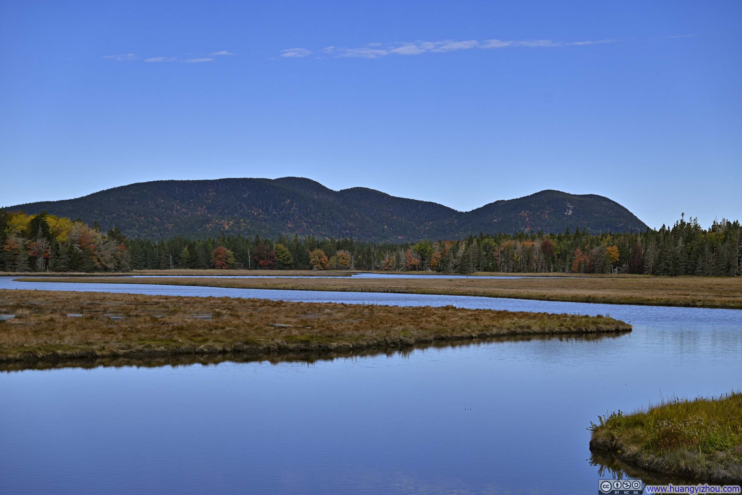
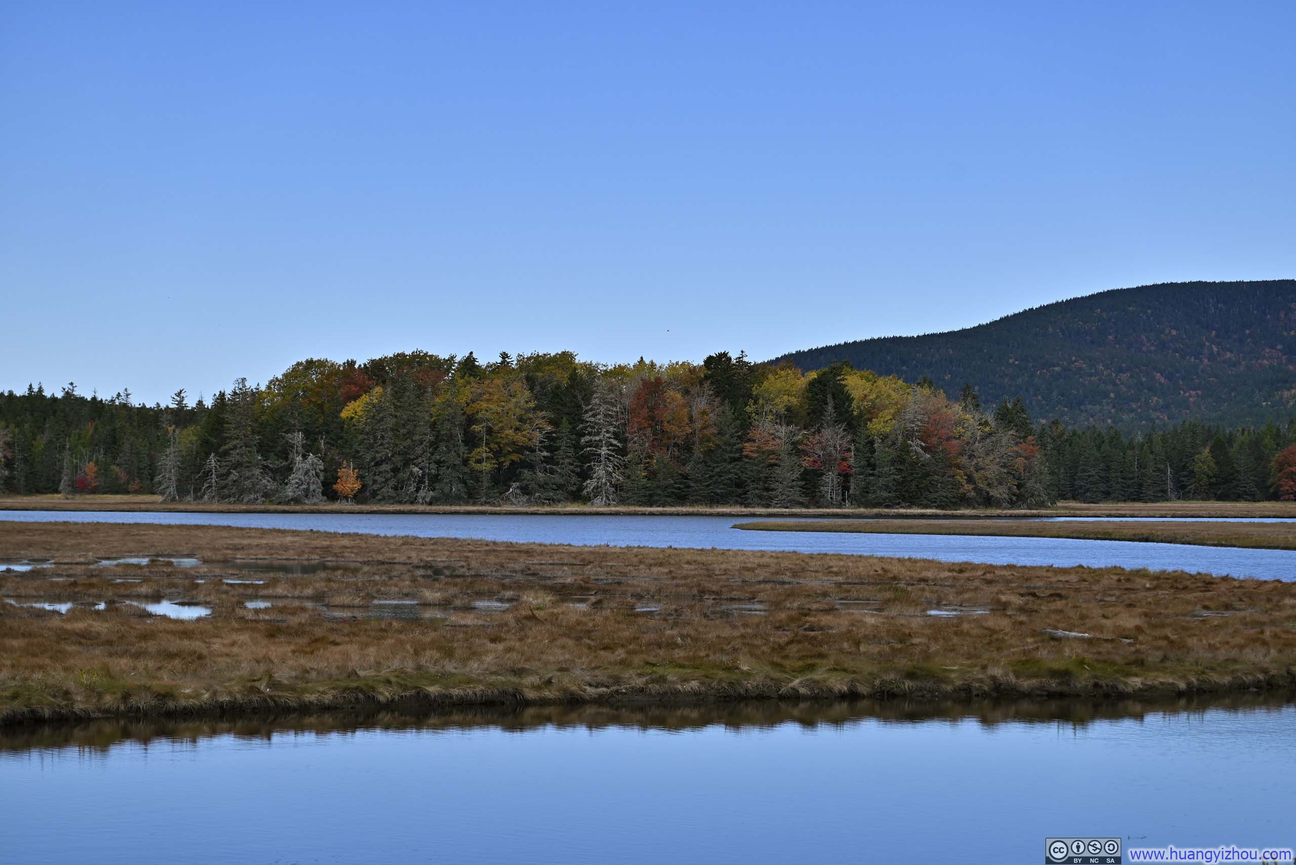
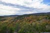
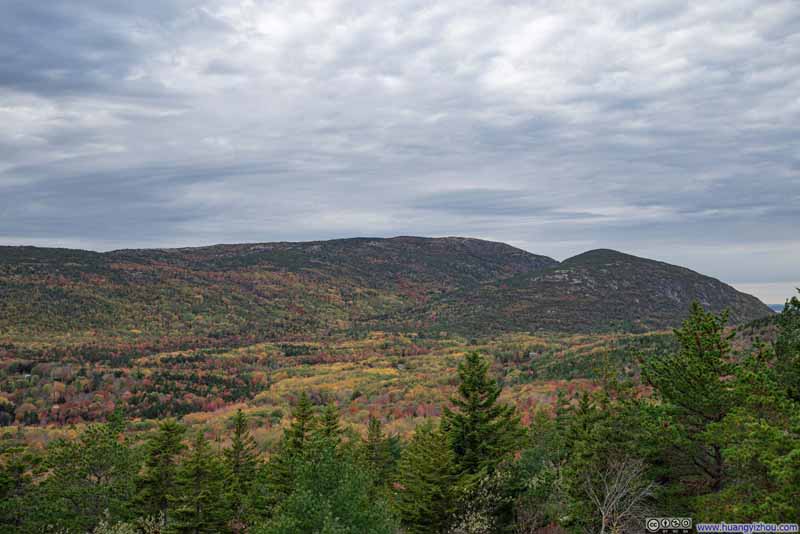
On my way to Bass Harbor Head Light, I recalled driving over a bridge with beautiful surrounding landscape, which turned out to be Bass Harbor Marsh. There, a winding river gracefully wove through a golden expanse of marshland, backdropped by forests wearing foliage colors and mirroring the blue skies above and the distant silhouettes of mountains on the horizon.
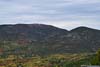
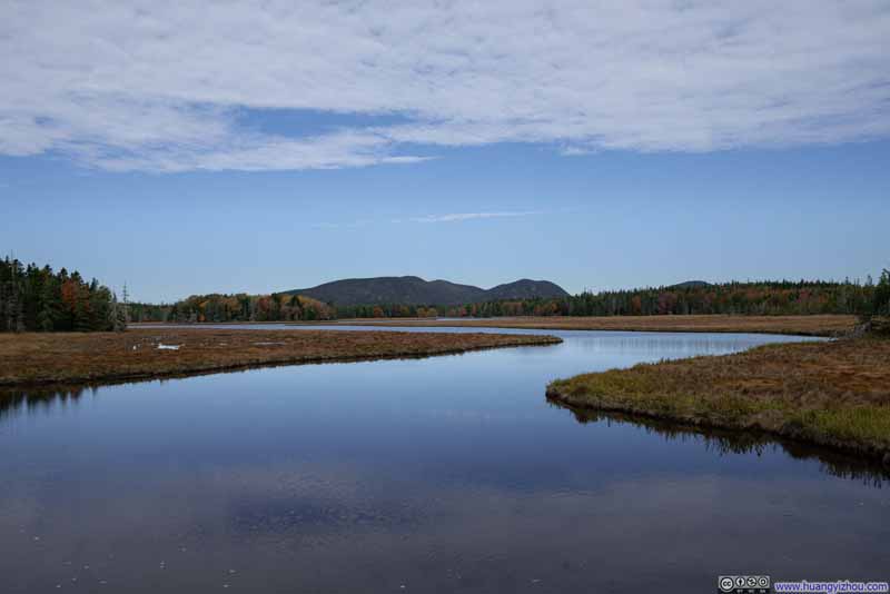 Mountains beyond Bass Harbor Marsh
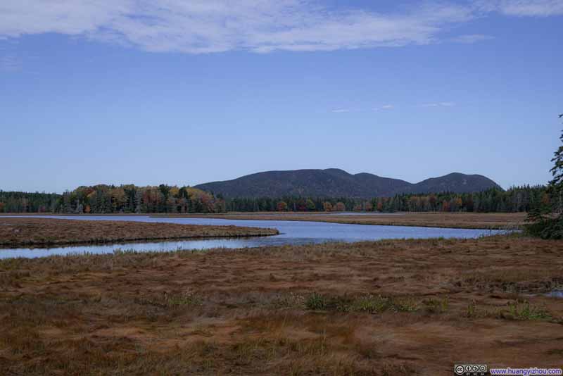 Mountains beyond Bass Harbor Marsh
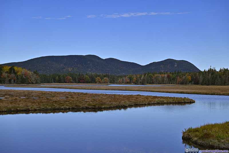 Mountains beyond Bass Harbor Marsh
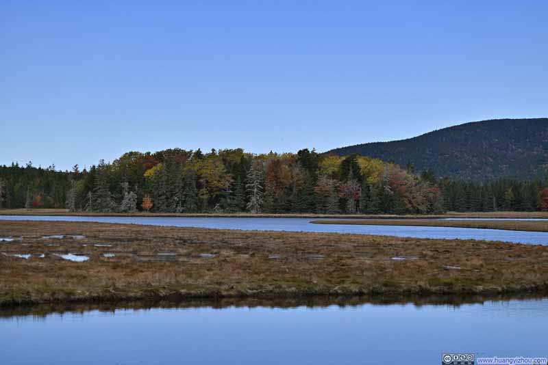 Trees along Marshall Brook
Click here to display photos of the slideshow
 Mountains beyond Bass Harbor Marsh
Trees along Marshall Brook
Schooner Head Overlook
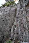
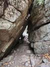
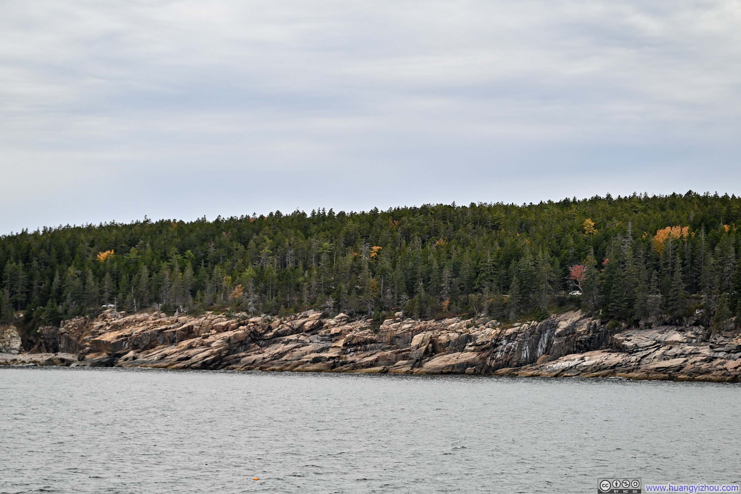
Leaving Bass Harbor Head Light, I headed towards the eastern coast of Mt Desert Island which was the heart of Acadia National Park. From Schooner Head Overlook, a short path led down the cliffs to Maine’s iconic rugged coastline.
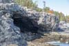
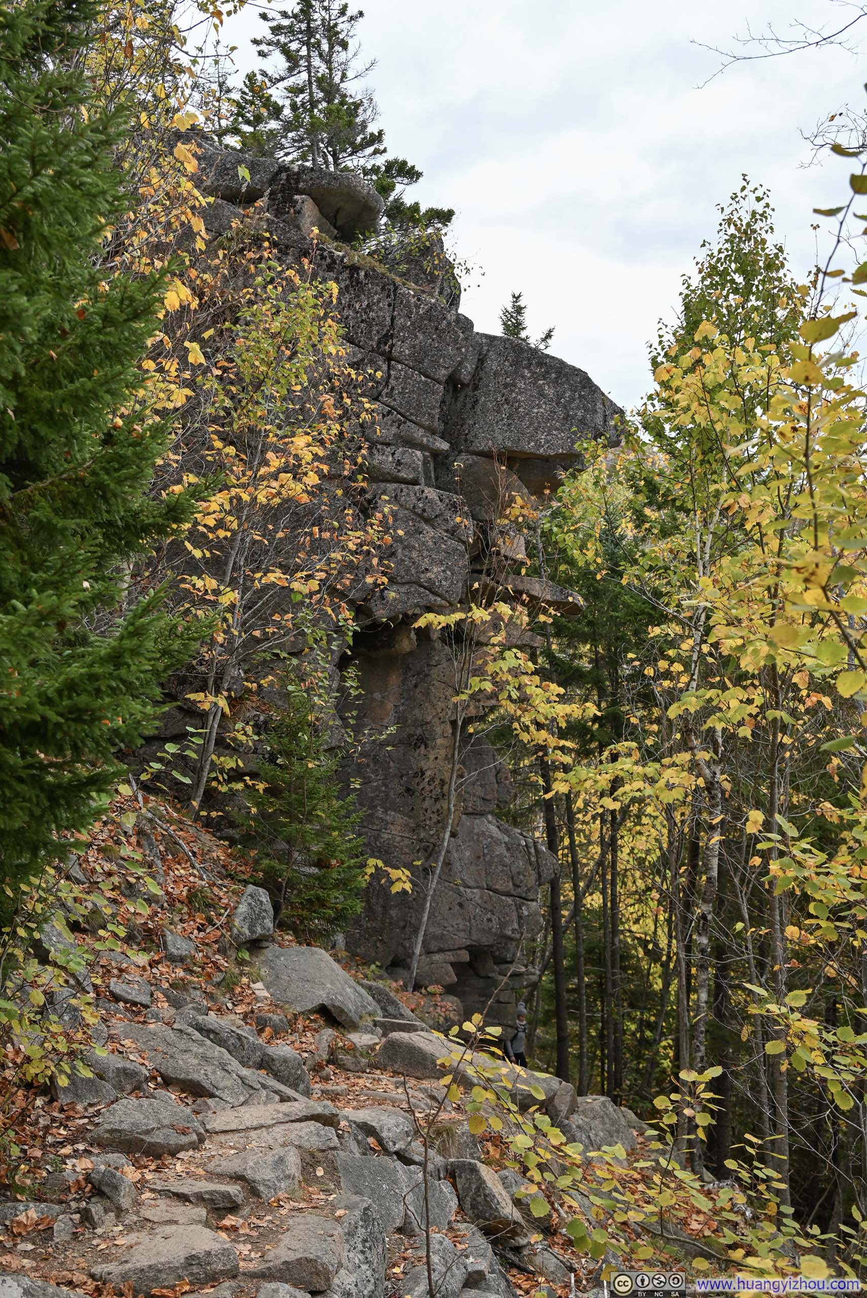
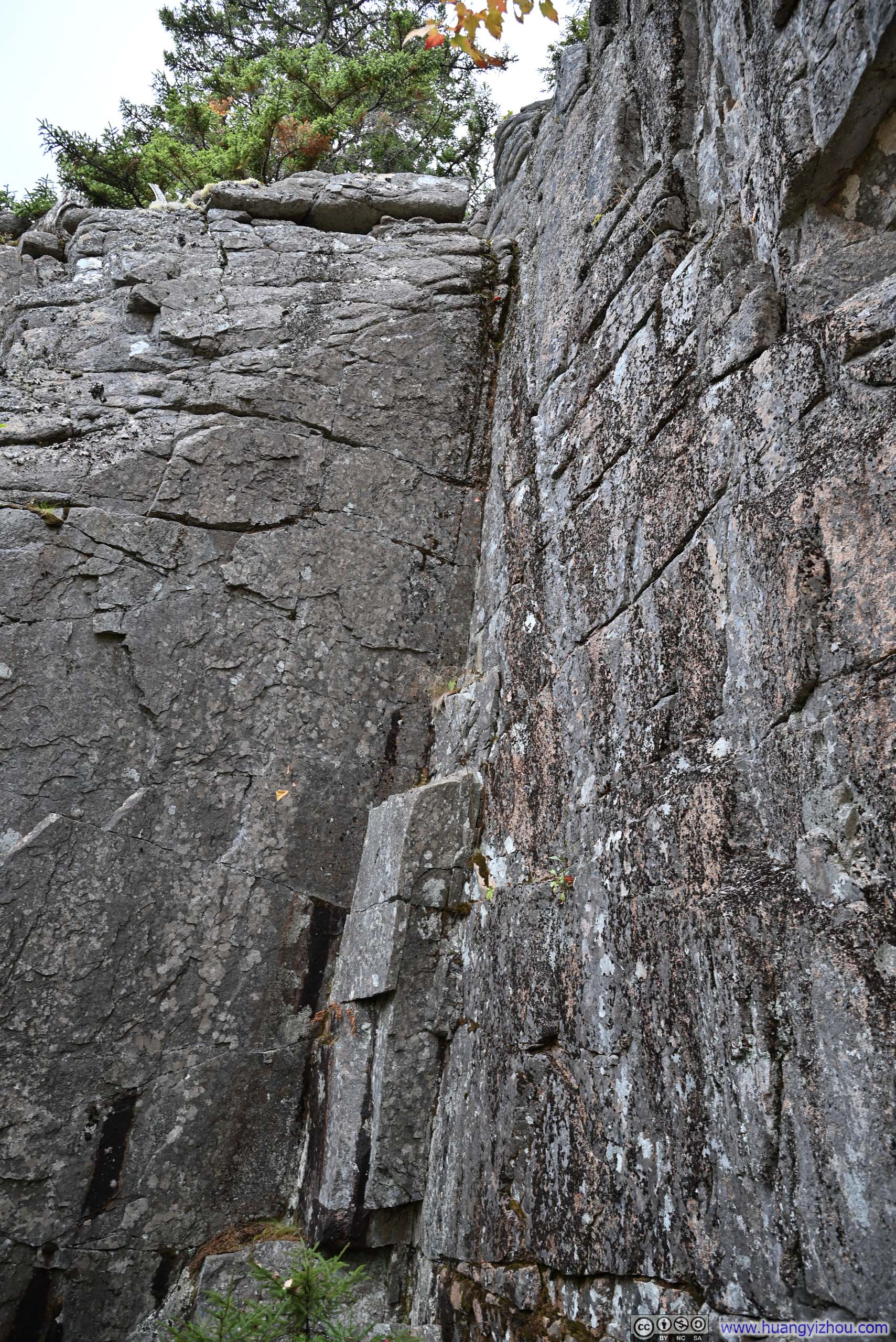
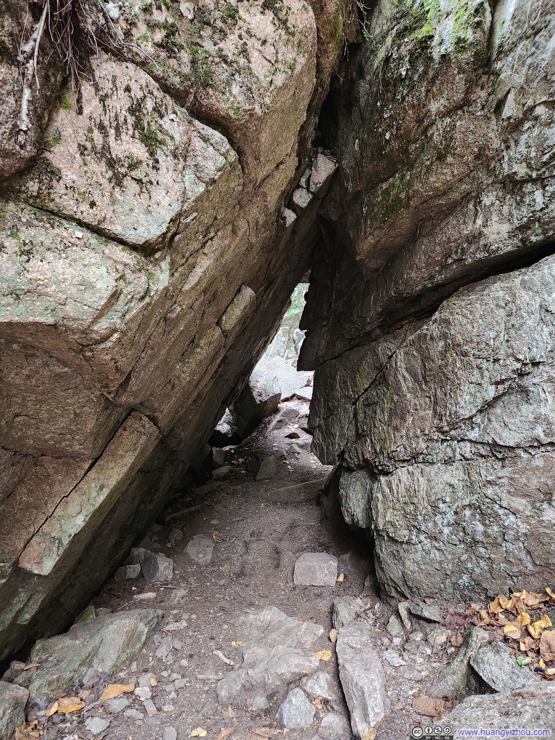
It’s worth mentioning that if one took a few steps off the trail toward the sea, one may find an “alcove” below the trail (p3 below). It’s much deeper than what it appeared from the outside that it’s classified as a cave, “Anemone Cave”. Interestingly, it has been removed from the park maps to protect its delicate ecosystem and to minimize the risk of hikers being injured or trapped inside. From what I could see, the rocks at the cave’s entrance were slick with ocean spray, making it clear that venturing into the cave would require both courage and skill.
 Rocky Shore
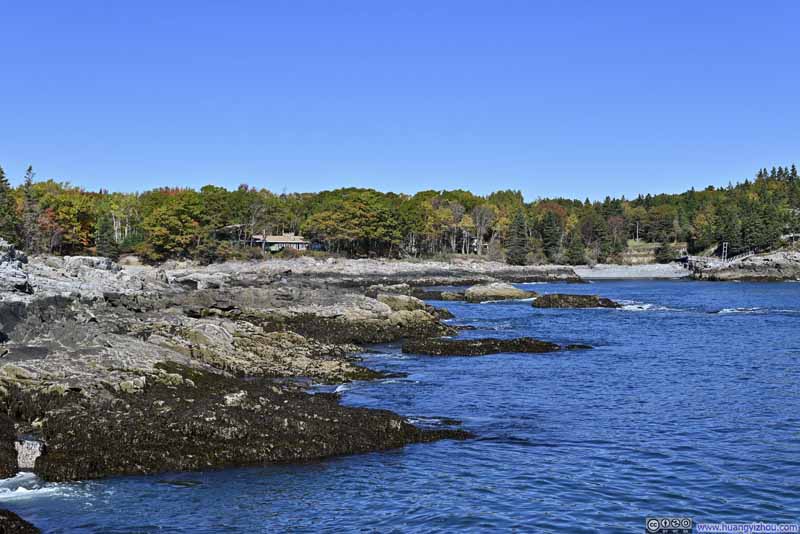 Rocky Shore
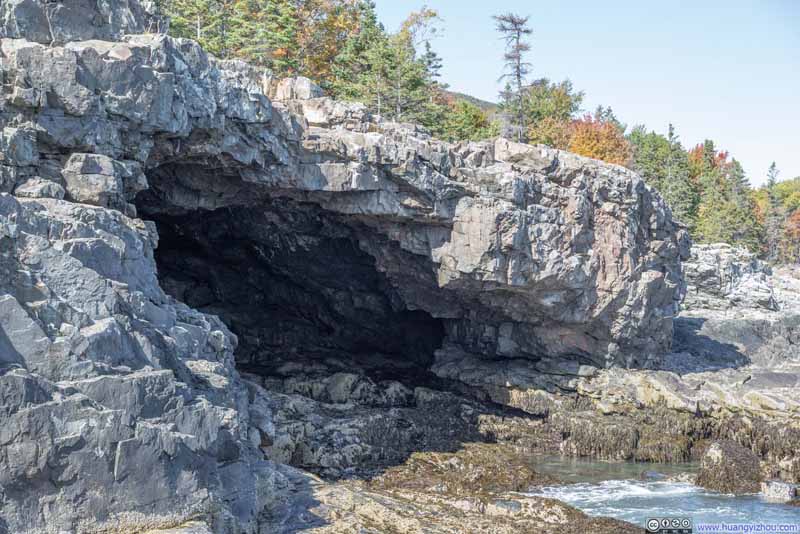 AlcoveLikely created by the erosion from the waves. This was actually classified as a cave.
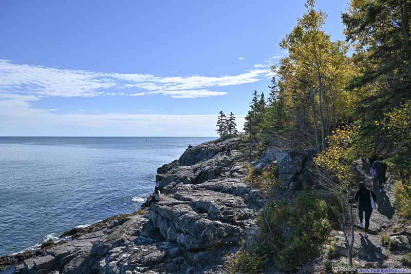 Rocky Shore
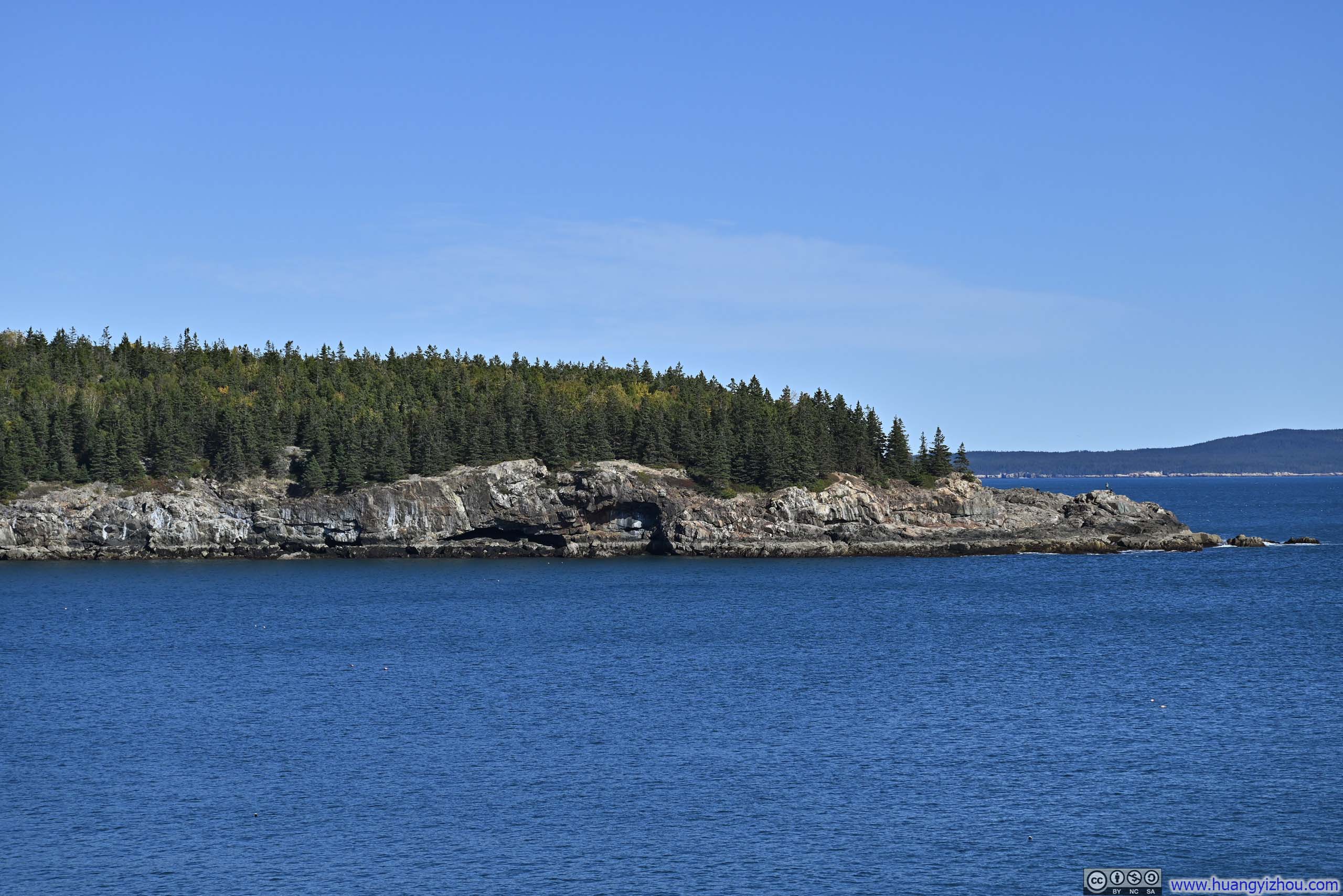
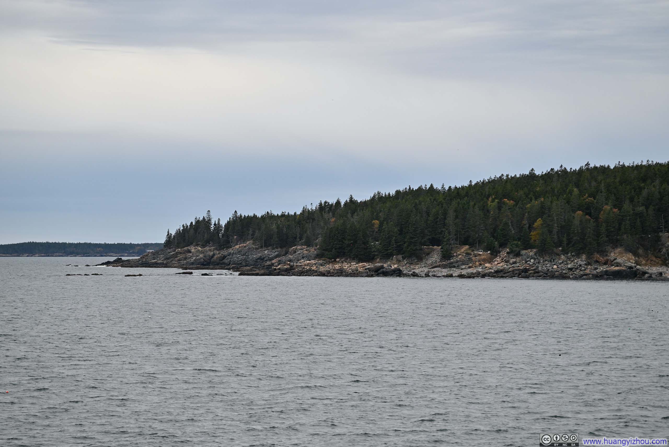
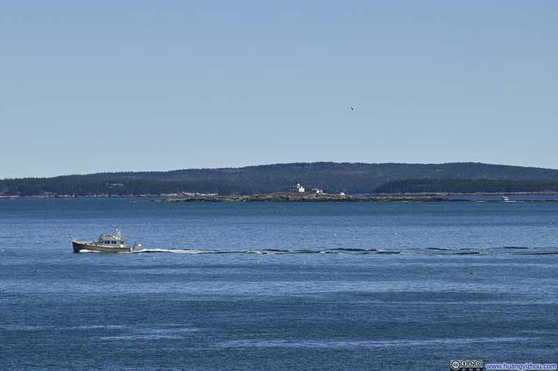 Egg Rock across Mt Desert Narrows
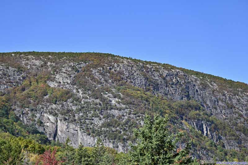 Champlain Mountain


Click here to display photos of the slideshow
 Rocky Shore

AlcoveLikely created by the erosion from the waves. This was actually classified as a cave.
Rocky Shore
Egg Rock across Mt Desert Narrows

Champlain Mountain
After Schooner Head Overlook, my original plan was to check out the nearby Great Head. Unfortunately, its small parking lot only held about 10 cars, and my patience ran out before a spot opened up. Actually, I had tried to visit Great Head before heading to Schooner Head, but the parking lot was full that time as well. From Schooner Head, there was already a line to enter Acadia National Park, so I decided to head towards Bar Harbor, hoping to explore Bar Island. The causeway connecting Bar Island to the mainland was only accessible at low tide, which would have made it a unique and memorable experience. Unfortunately, after circling downtown Bar Harbor for quite a while, I couldn’t find any parking spots. With no other options, I ended up driving back toward Schooner Head to join the line to enter Acadia National Park.
It turned out that in addition to being peak foliage weekend, two additional factors contributed to the excessive crowds at Acadia National Park that day:
- It’s Columbus Day long weekend.
- Weather forecast for the next day wasn’t promising, so people were eager to enjoy the outdoors today.
In the end, I was stuck in the line for 20 minutes just to enter Acadia National Park. But just as I thought the ordeal was over, it turned out that there was a secondary traffic jam inside Acadia National Park, as people attempting parallel parking along the road were holding up the flow of traffic behind. It took me 20 minutes to find a spot to park, between Thunder Hole and Otter Cliff. Ultimately, there was just too much traffic than the park could handle, so I wouldn’t be surprised if Acadia decided to enact a timed-entry system in the near future.
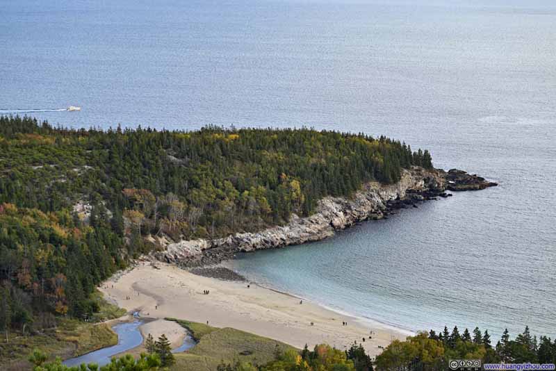
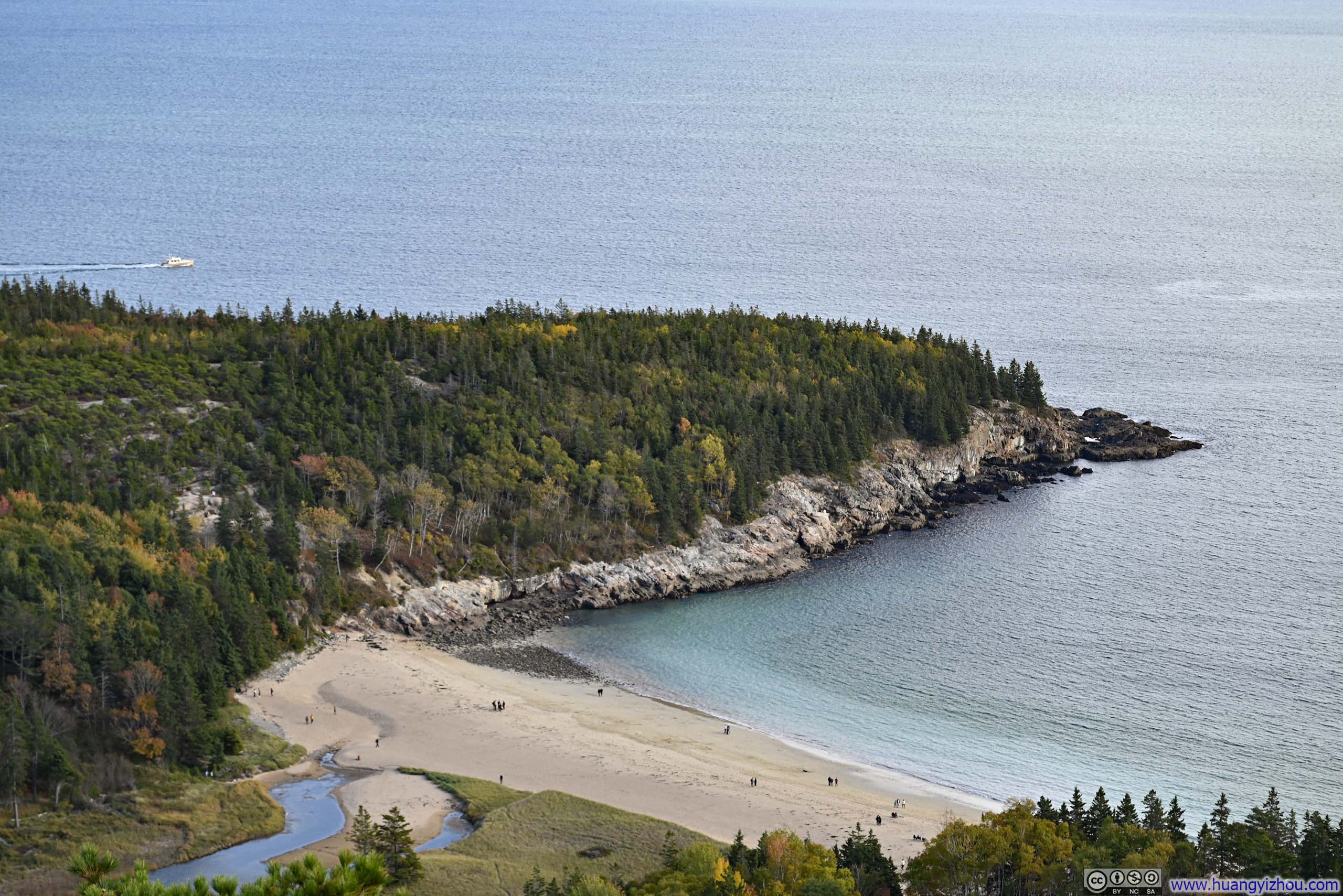
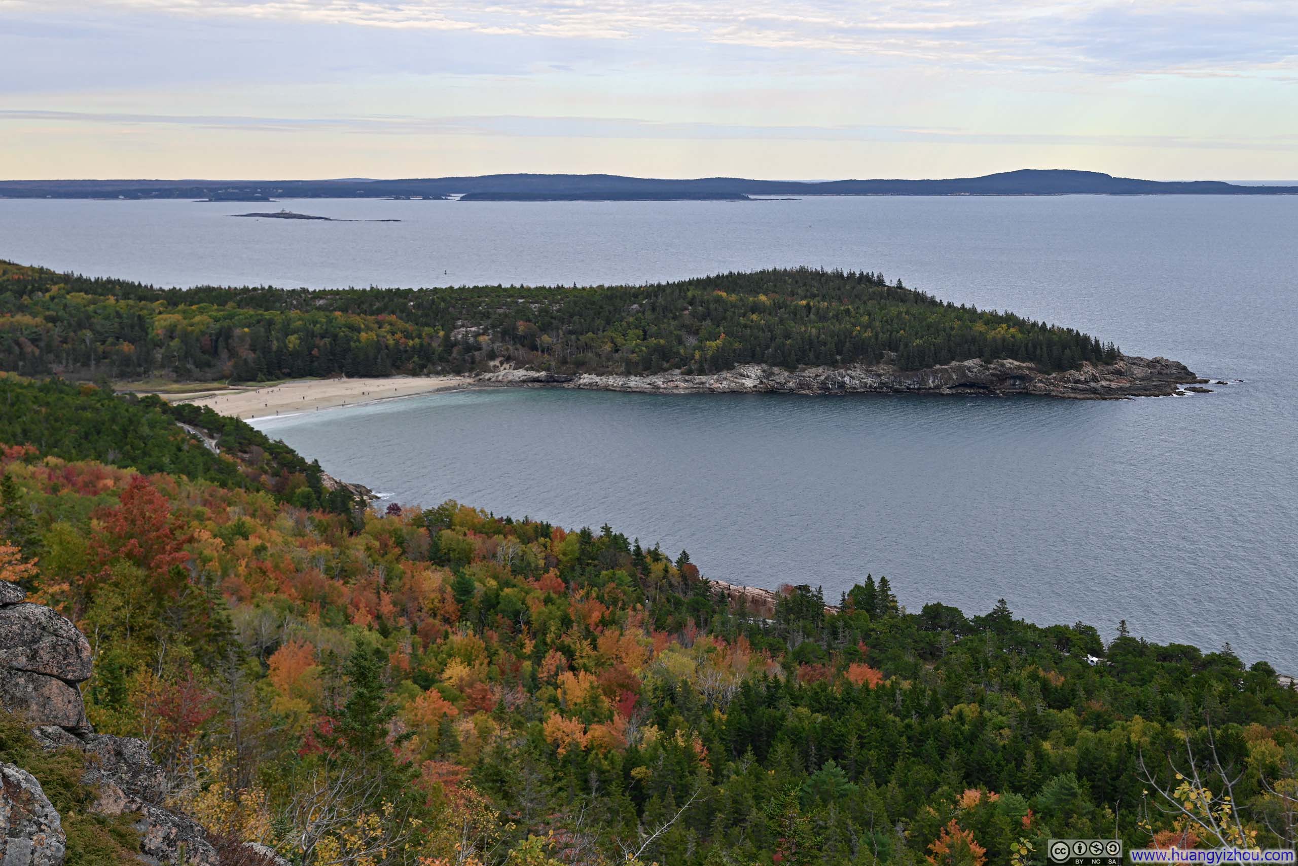
Initially, my plan was to take the short version of Beehive loop, but given where I had parked, it only made sense for me to include Gorham Mountain for a longer loop. Before starting the Beehive-Gorham hike, I paid the nearby Sand Beach a visit (mainly to use the bathrooms). Among Maine’s rugged coastline, the presence of such a sandy beach felt like a rare and delightful novelty.
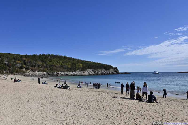 Sand Beach
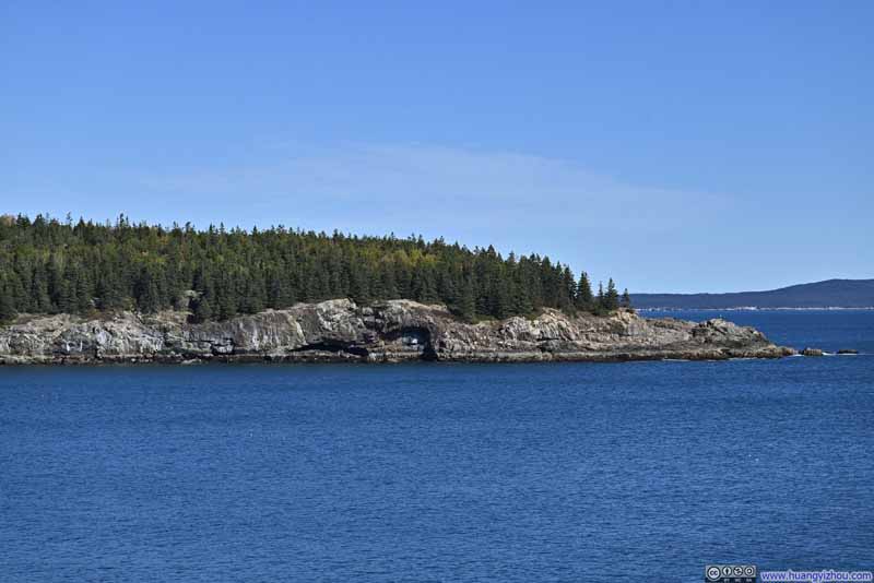 Peninsula
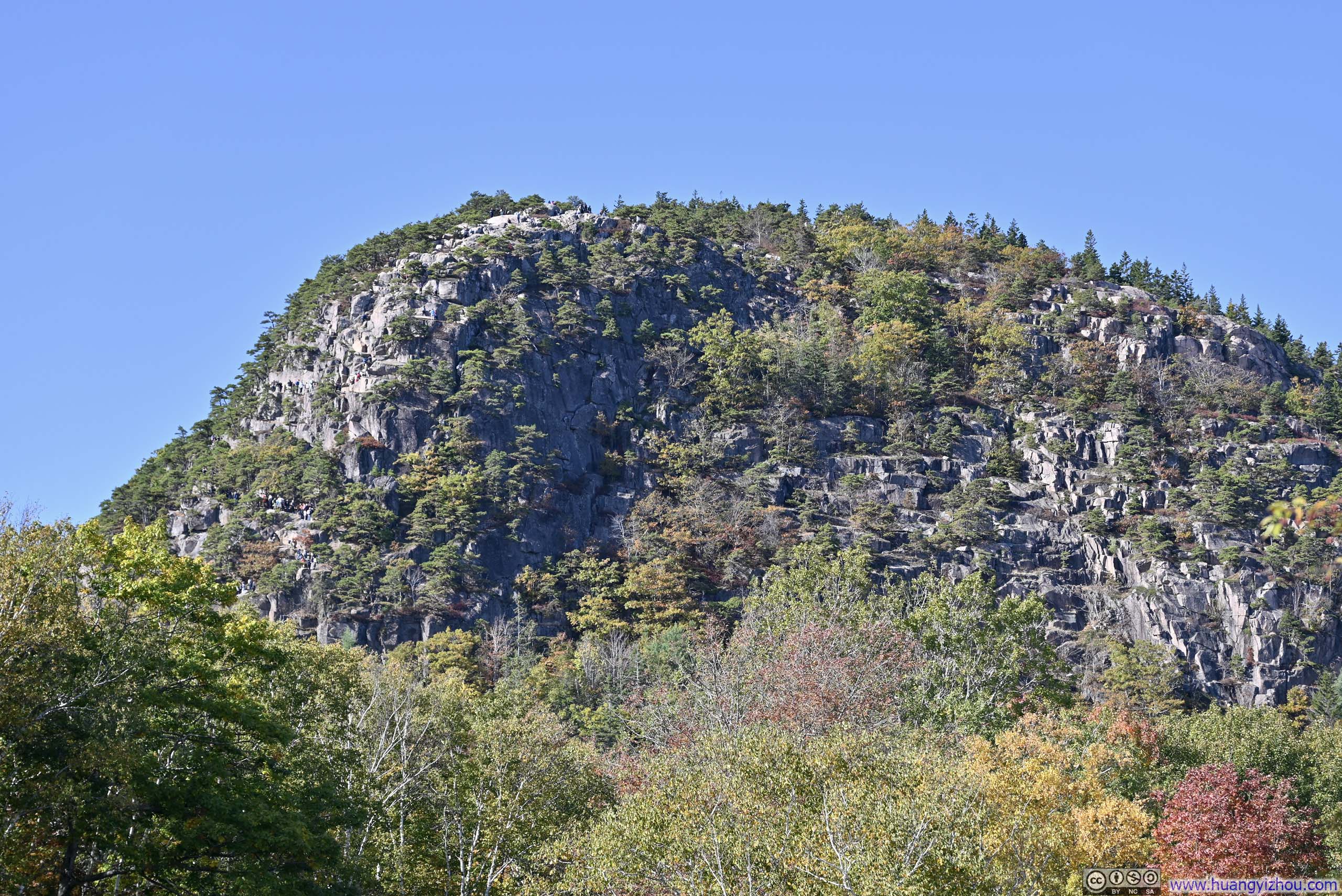
 The Beehive

Click here to display photos of the slideshow

Sand Beach
Peninsula
The Beehive
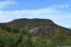
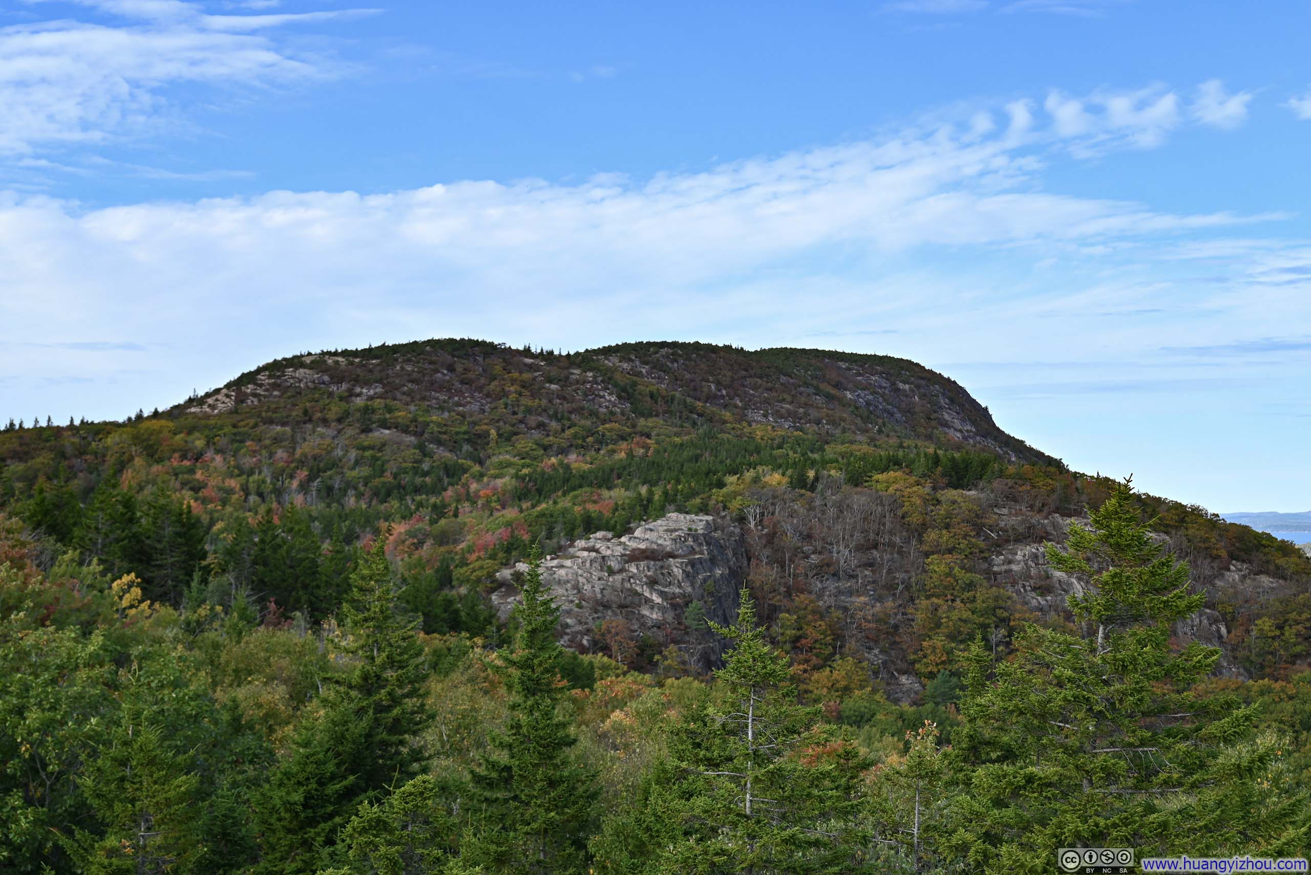
Beehive-Gorham Loop Hike
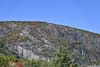
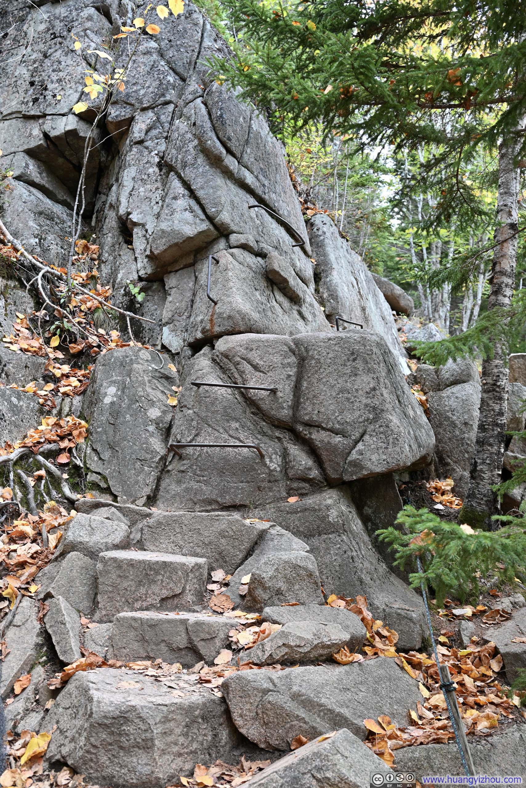
The Beehive Trail was like a scaled-down version of the Precipice Trail that I hiked the previous day. With the help of iron rungs, it ascended a steep cliff that overlooked the coastline below. However, Beehive was not as tall as Champlain Mountain of Precipice Trail, and the climb wasn’t as exposed.
Unfortunately, this also meant the trail was far more crowded, attracting people less accustomed to climbing. Instead of the fun blast along Precipice that I had the previous day (that I anticipated), it was a constant traffic jam along Beehive Trail. I could have climbed Beehive in 10 minutes, the traffic added an additional 60 minutes and completely drained any enjoyment this trail could have offered. (Worse, I had no cellular signal along the trail.)
And since Beehive Trail brought such a torturous experience, I won’t mention it in detail here.
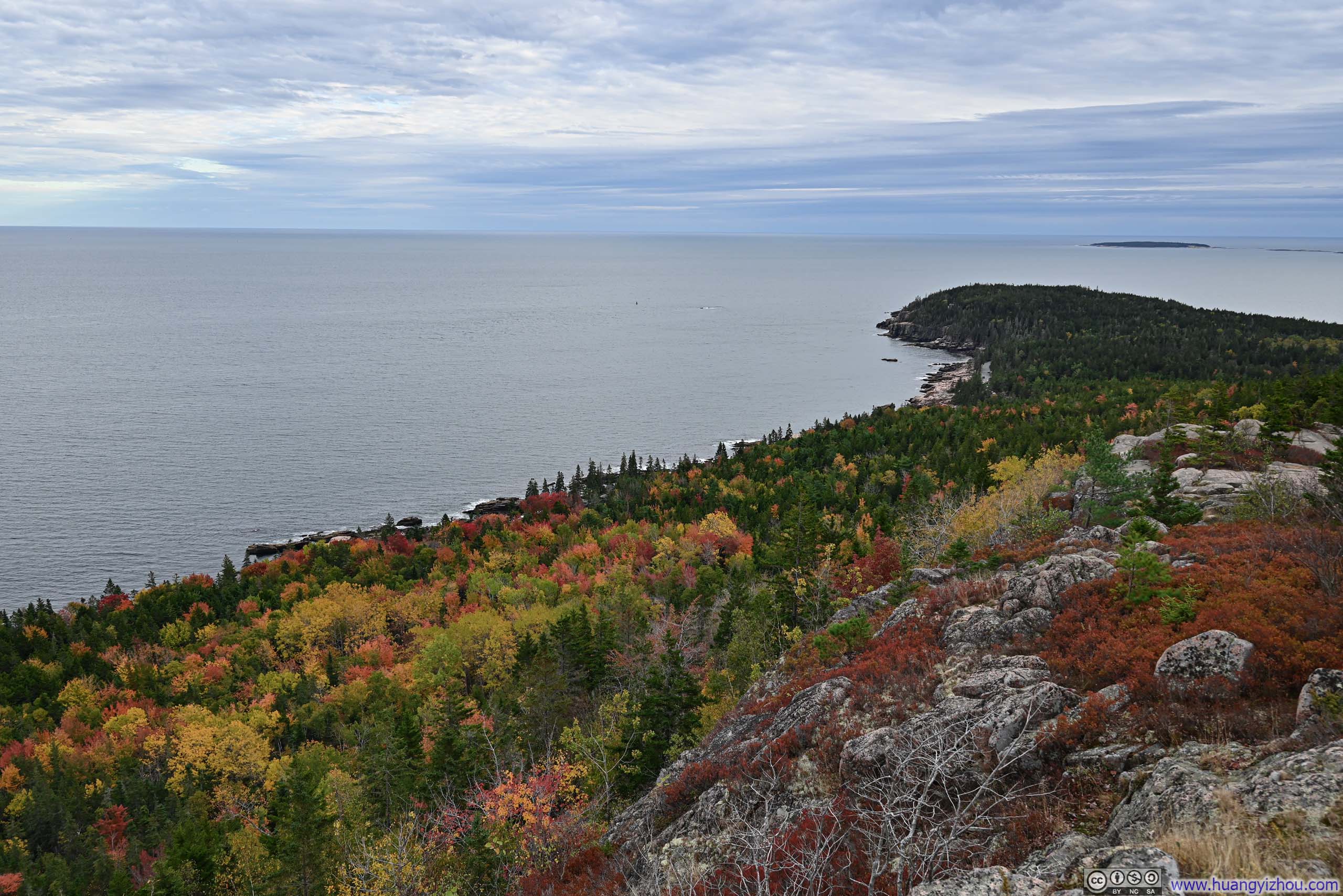
On top of Beehive, there were some decent views of the surrounding landscape. Beehive wasn’t the tallest mountain in the area, and after a disappointing climb, I wasn’t in the mood to appreciate them.
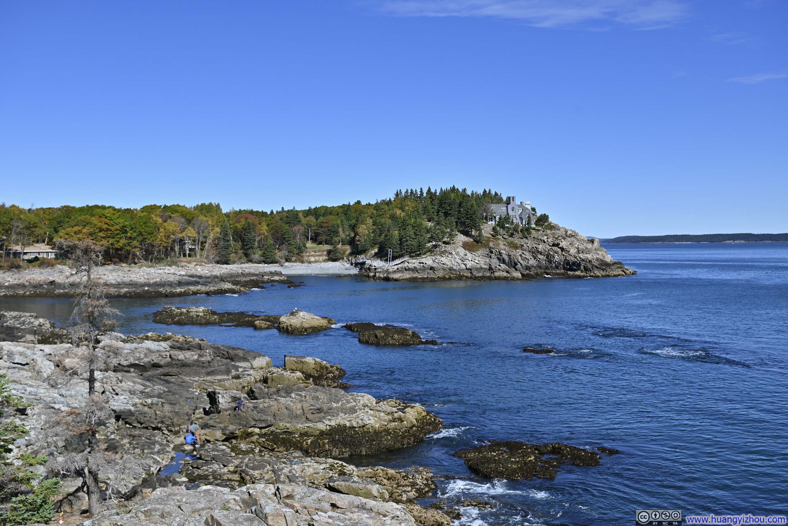
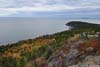
 Overlooking Newport Cove
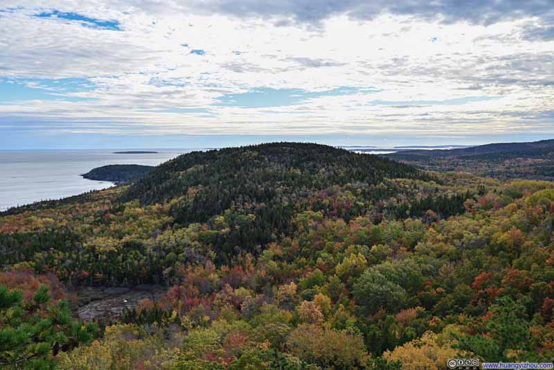 Gorham Mountain
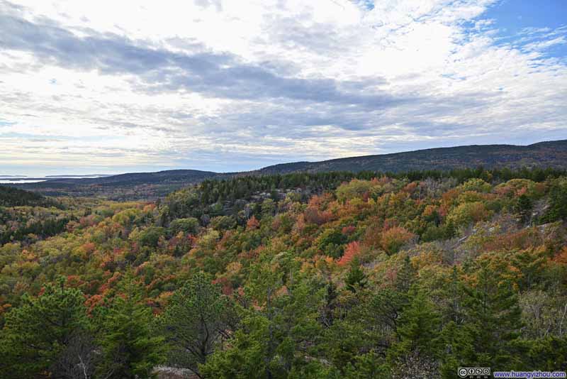 Foliage
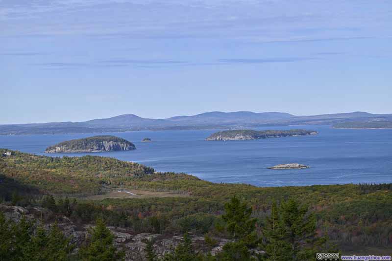 Islands in Frenchman Bay
 Champlain Mountain
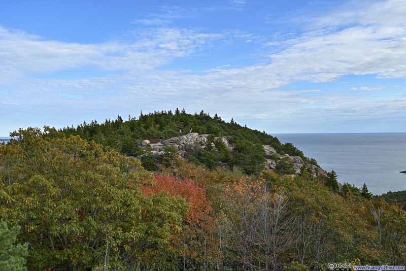 Exposed Rocks on Beehive Mountain

Click here to display photos of the slideshow
Overlooking Newport Cove
Gorham Mountain

Foliage

Islands in Frenchman Bay
Champlain Mountain

Exposed Rocks on Beehive Mountain
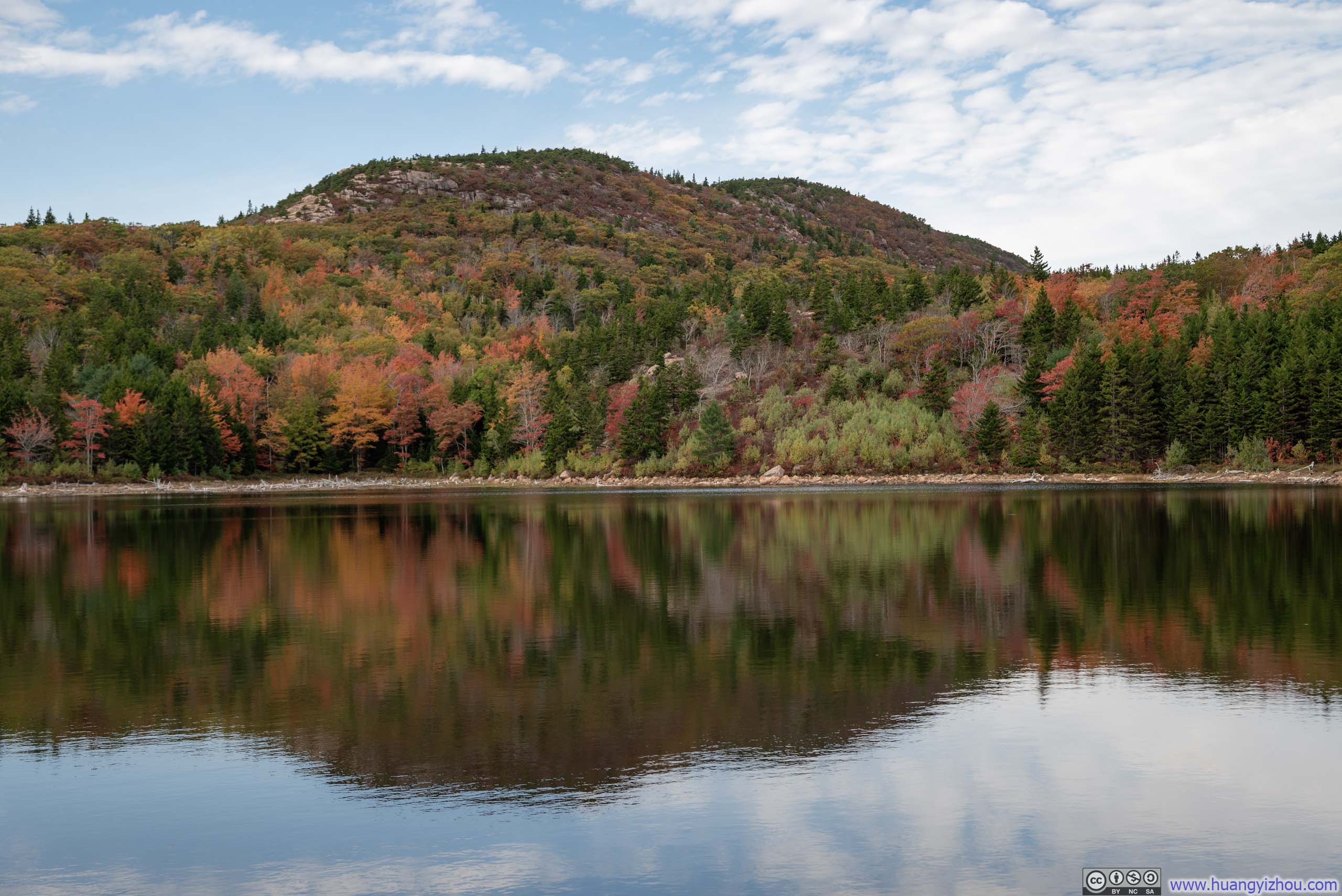
However, I found some consolation further along the trail at “The Bowl”, which was a lake with tranquil waters surrounded by beautiful foliage. More importantly, it’s a stark contrast to the overcrowding that I had endured on the Beehive Trail. It’s as if its relatively seclusion possessed some kind of quite magic to sooth my frayed nerves.
 The Bowl
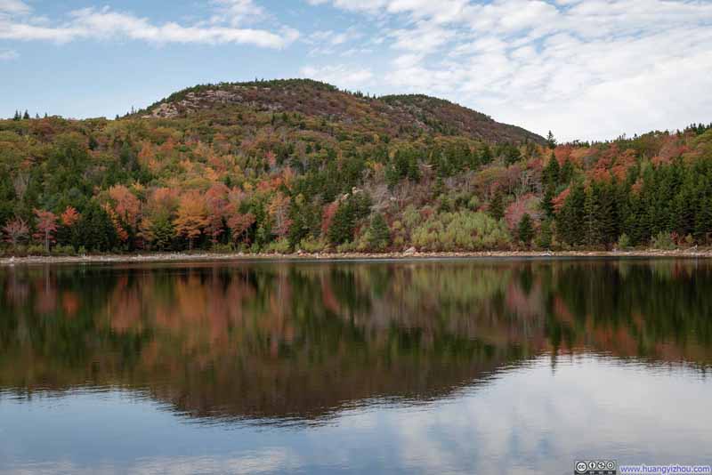 The Bowl
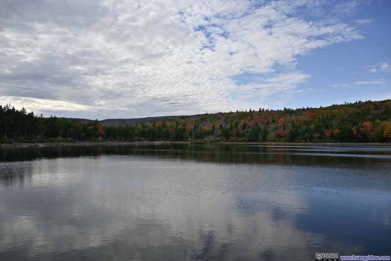 The Bowl

Click here to display photos of the slideshow

 The Bowl
The Bowl
 Trail
Trail
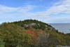
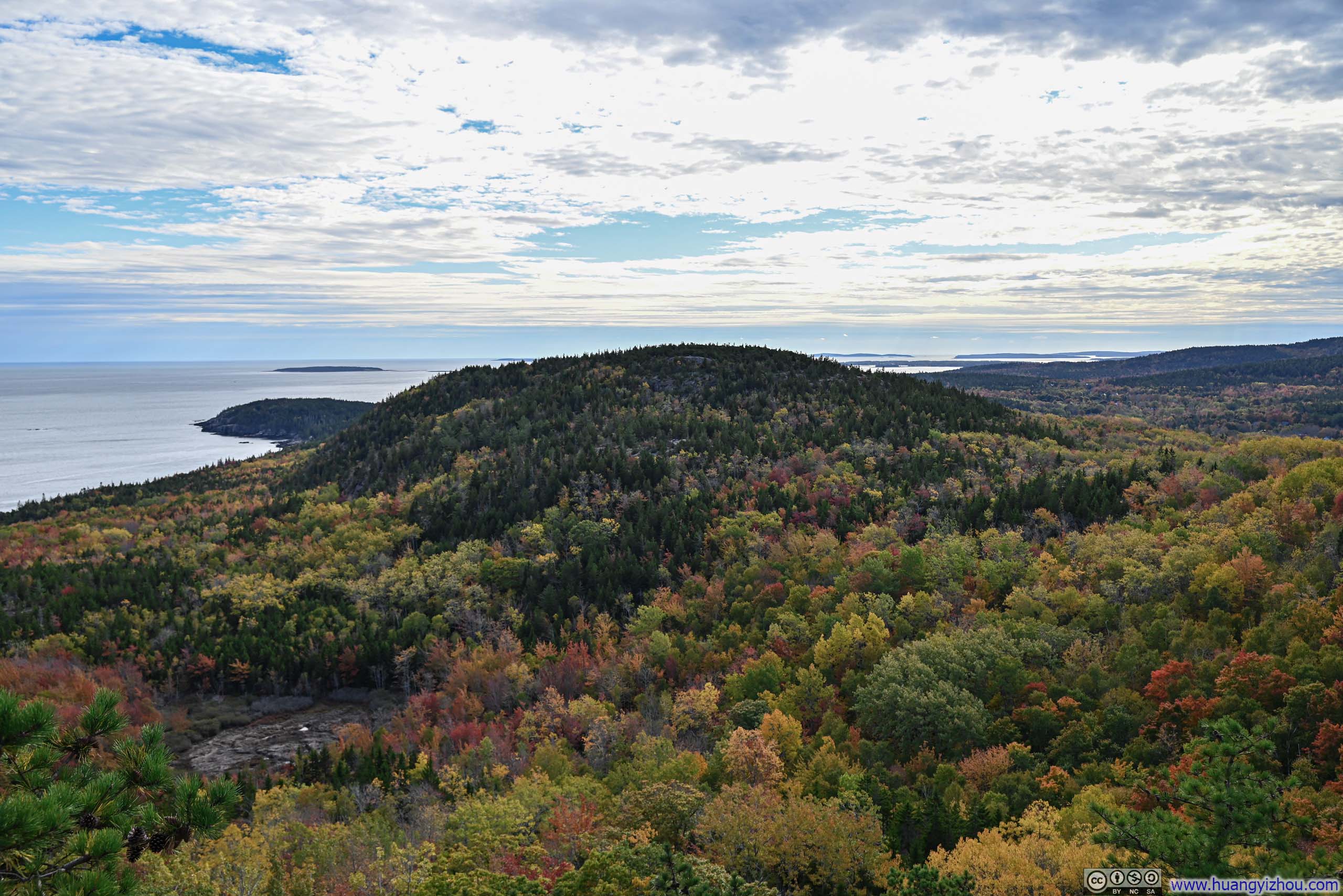
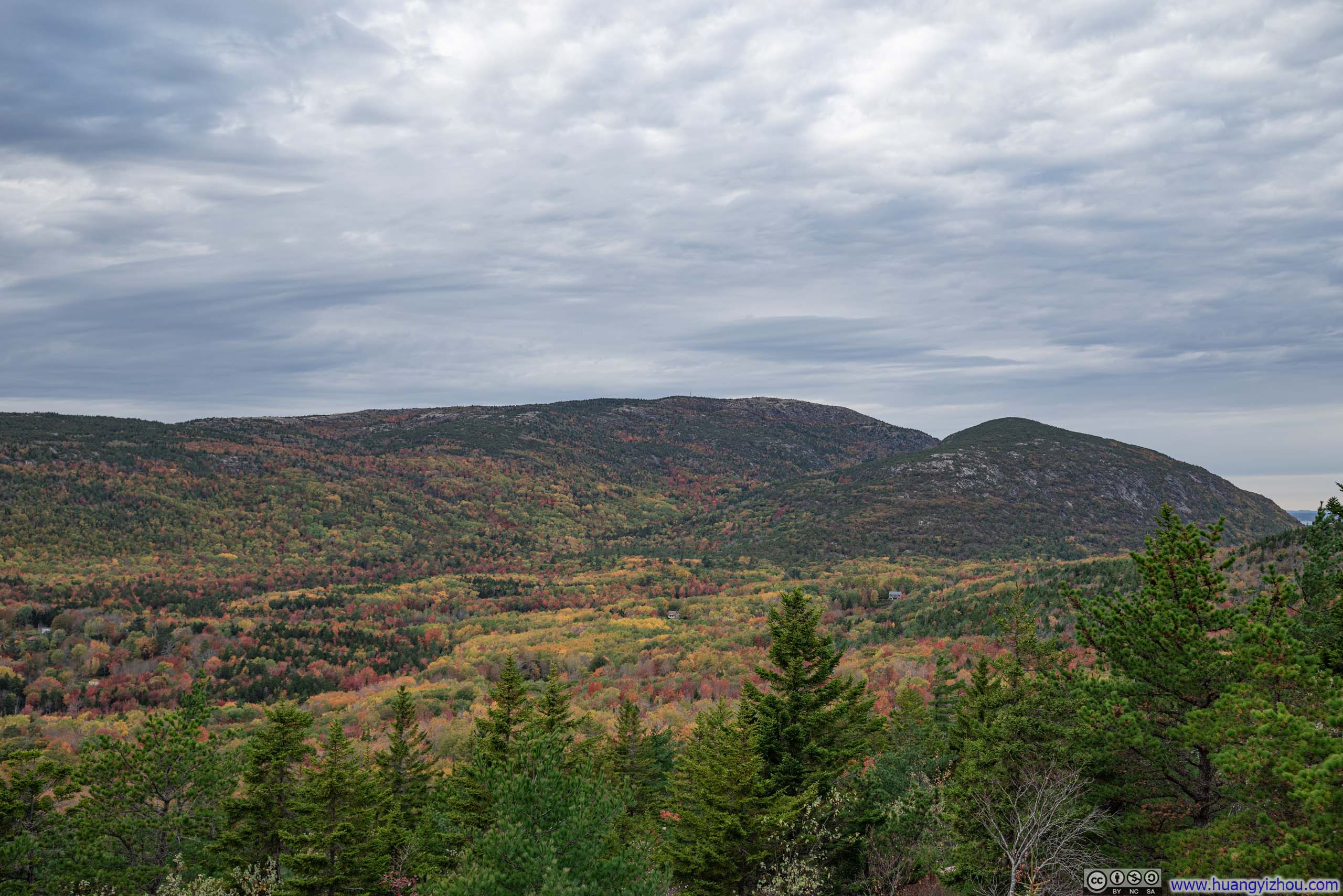
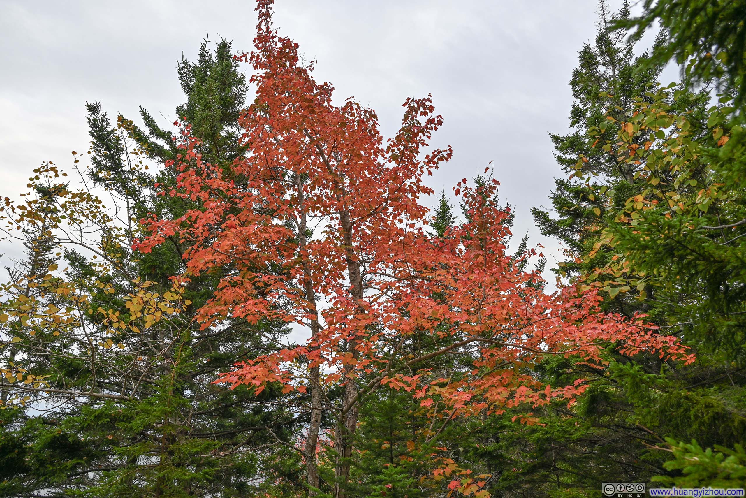
Finally, Gorham Mountain brought salvation as it presented a dazzling display of colors of the southern flank of Cadillac Mountain, likely the most enchanting that I witnessed in Acadia throughout this trip. (It also helped to have a cloudy overhanging sky, softening what would otherwise be harsh afternoon light.)
 Cadillac Mountain and Champlain Mountain
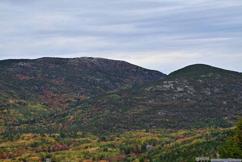 Cadillac Mountain and Champlain Mountain
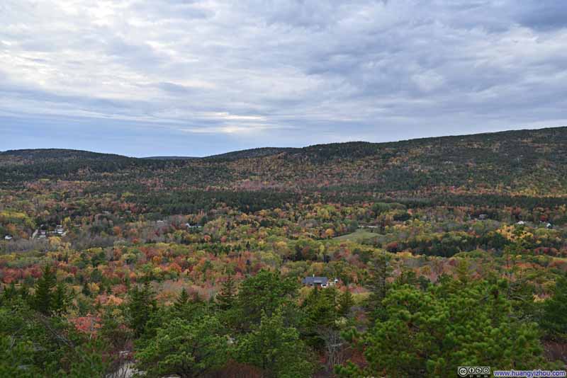 Village of Otter Creek
 Otter Cove and Distant Cranberry Isles
Click here to display photos from Gorham Mountain.
 Cadillac Mountain and Champlain Mountain

Village of Otter Creek
Otter Cove and Distant Cranberry Isles
View from Gorham Mountain
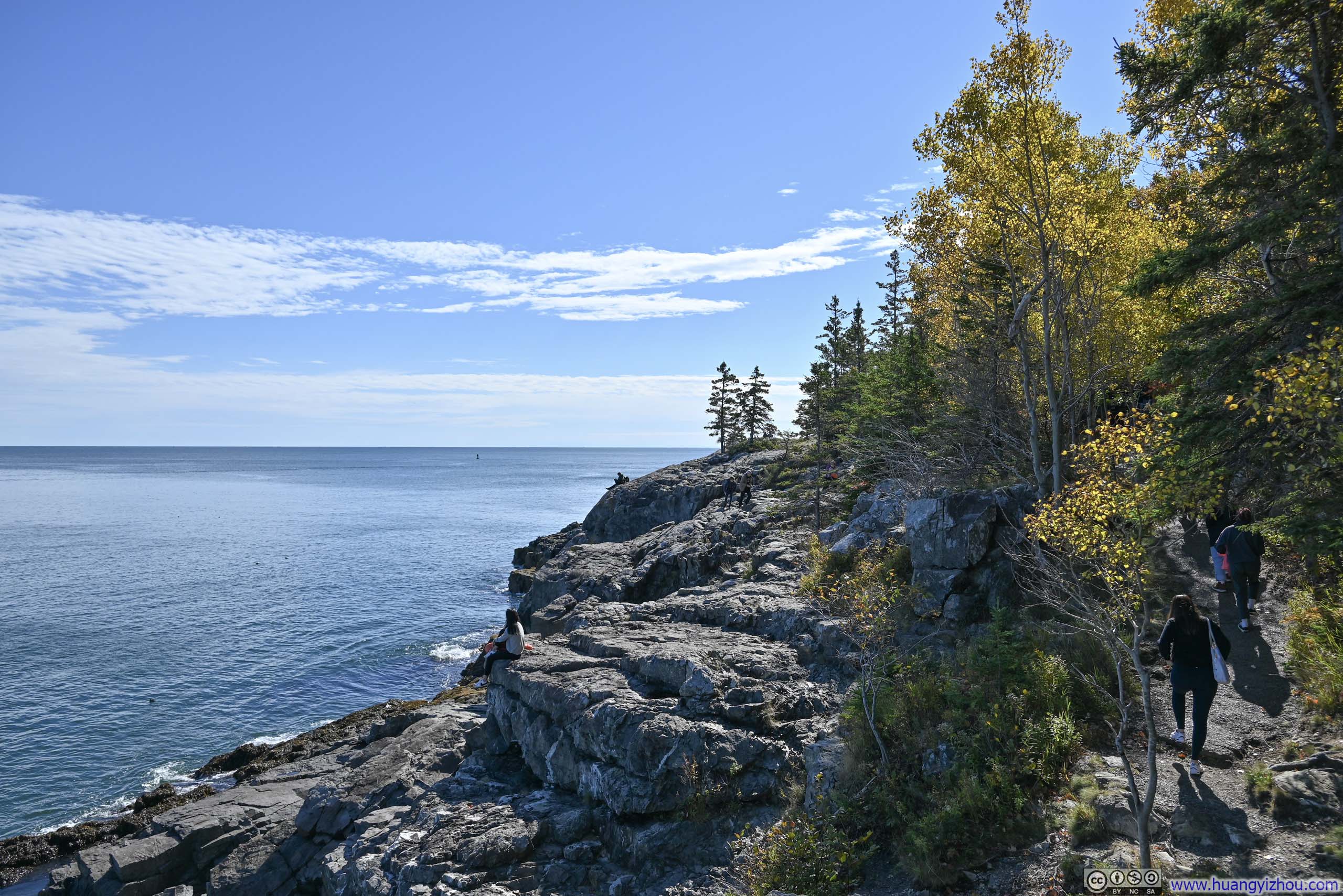
Continuing on, a few (unofficial) overlooks along the trail offered views overlooking the coastline, and the foliage in between the mountain and the sea.
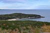
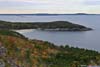
 Newport Cove
 Newport Cove
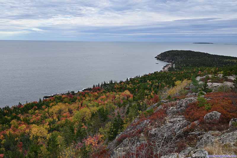 Shore of Mt Desert Island
 Foliage on Tree

Click here to display photos of the slideshow

Newport Cove
Newport Cove
Shore of Mt Desert Island
Foliage on Tree
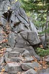
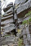
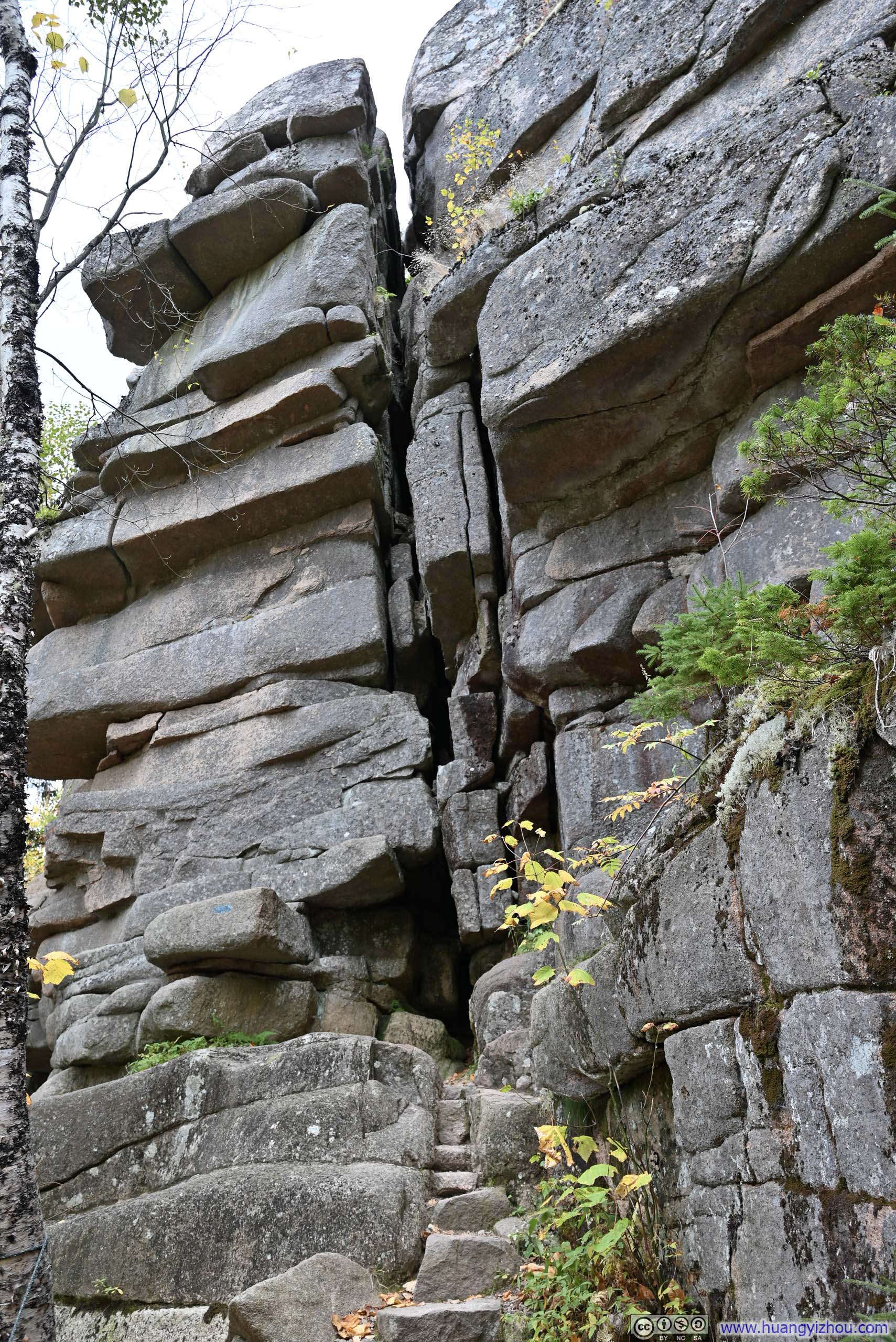
Later on, the trail forked into two branches (both ways through). I opted for the more exciting Cadillac Cliffs Path (the eastern one), which followed the base of extensive rocky cliffs.
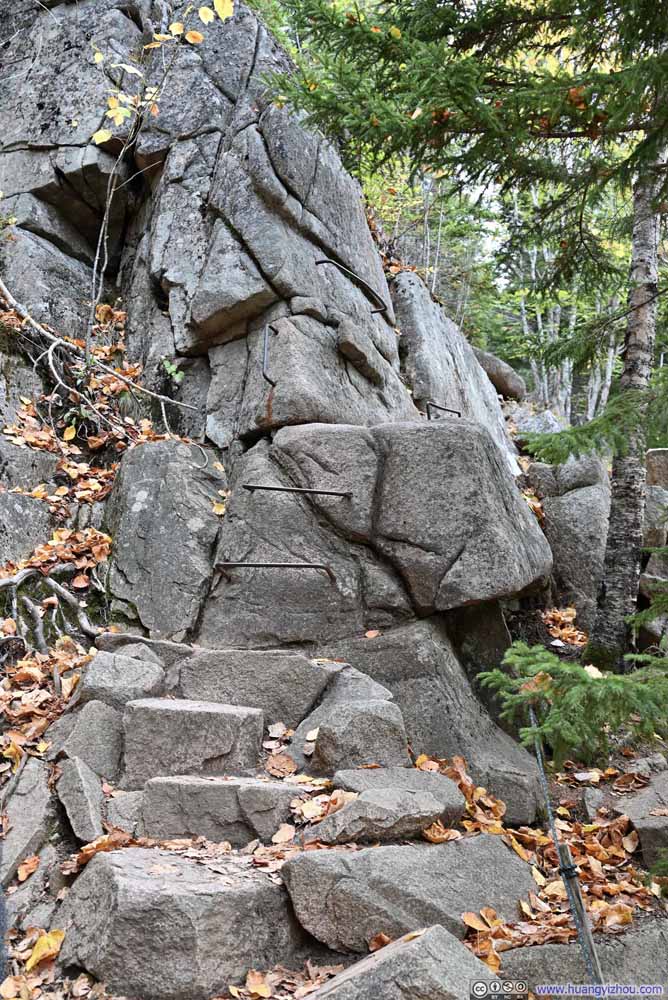 Trail on Metal Rungs
 Cliffs
 Trail under Cliffs
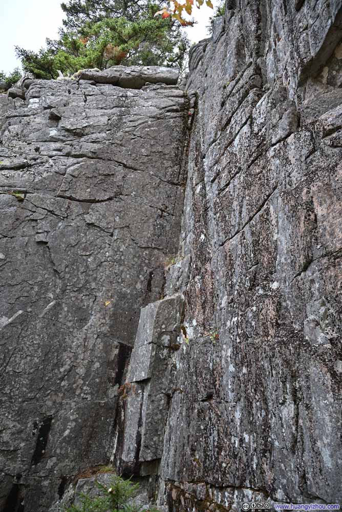 Cliffs
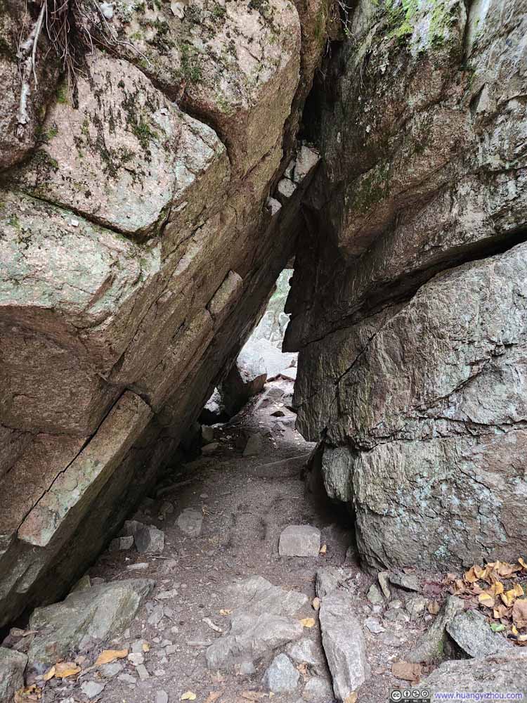 Trail
Trail

Click here to display photos of the slideshow
Trail on Metal Rungs
Cliffs
Trail under Cliffs
Cliffs
Trail
 Rocky Shoreline
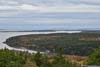
Drone Tour of Somes Sound
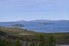
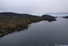
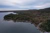
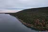
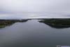
Since Mt Desert Island was a habited island before the establishment of Acadia National Park, not all of its land was managed by NPS. Therefore, I found a spot along Somes Sound outside the park boundary and launched my drone for an aerial tour of the sound. Somes Sound resembled a long and narrow fjord, but was technically classified as a fjard given its lack of vertical relief.
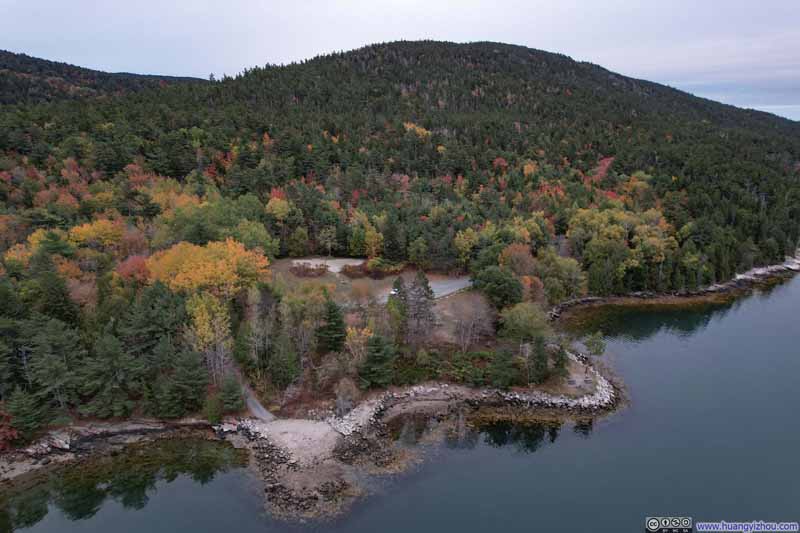 Overlooking Suminsby Park
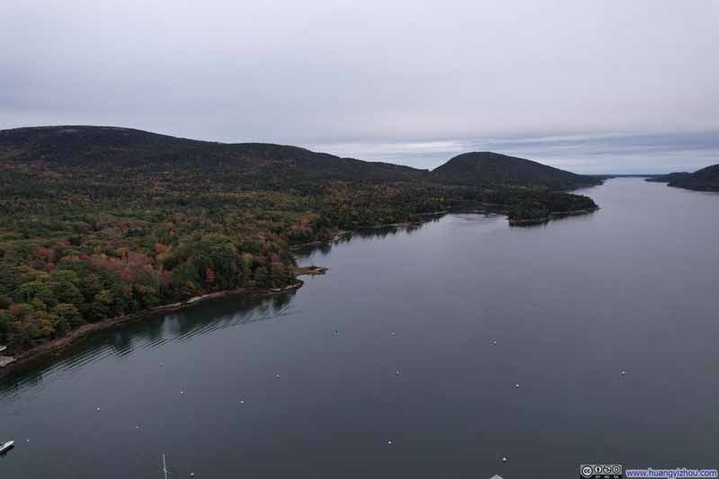 Sargent Cove along Somes Sound
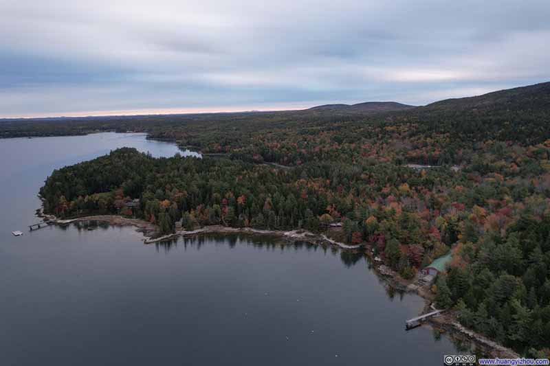 Shores of Somes Sound
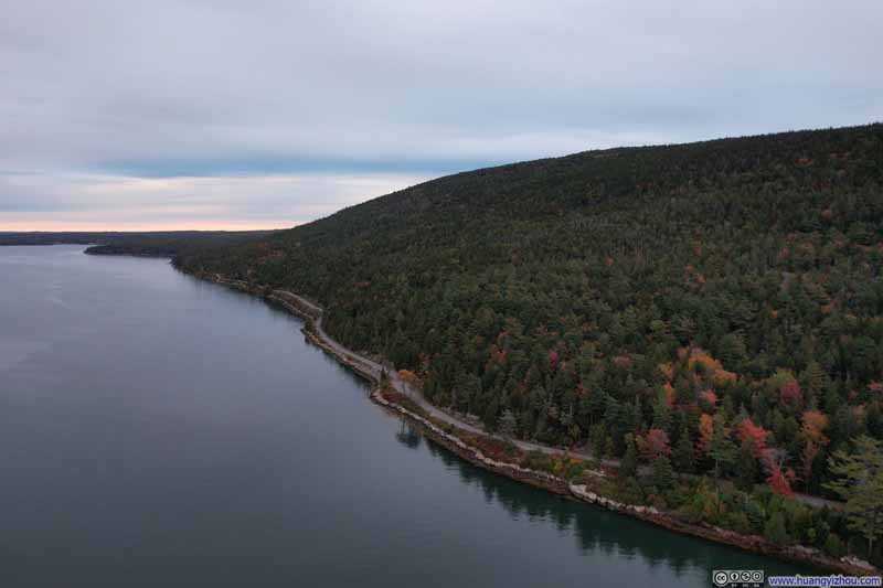 Road along Somes Sound
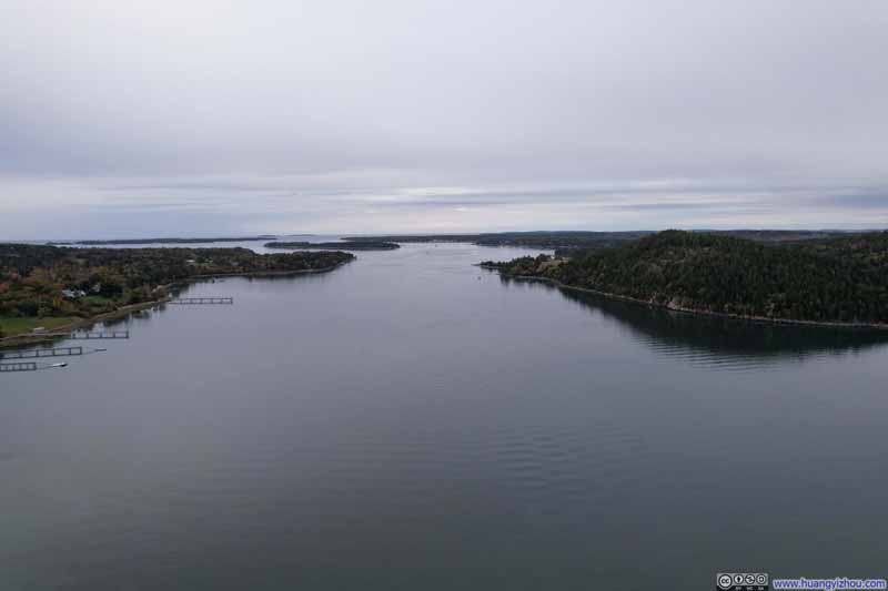 Mouth of Somes Sound
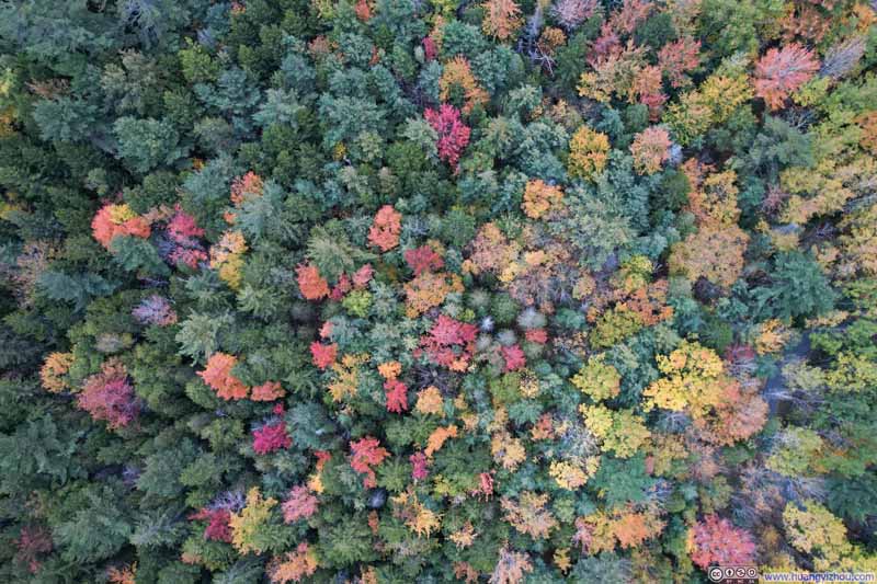 Overlooking Forest in Foliage

Click here to display photos of the slideshow

Overlooking Suminsby Park
Sargent Cove along Somes Sound

Shores of Somes Sound
Road along Somes Sound

Mouth of Somes Sound

Overlooking Forest in Foliage
 Overlooking Somes SoundNear its mouth (top), in the middle (center) and near its end (bottom).
And here’s a video:
After that, I drove back home and concluded this trip to Acadia.
END
![]() Day 3 of October 2024 Trip to Acadia National Park by Huang's Site is licensed under a Creative Commons Attribution-NonCommercial-ShareAlike 4.0 International License.
Day 3 of October 2024 Trip to Acadia National Park by Huang's Site is licensed under a Creative Commons Attribution-NonCommercial-ShareAlike 4.0 International License.